| Ahjumawi Lava Springs State Park | |
|---|---|
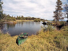
 View east from the Ja-She Campground | |
| Location | Shasta County, California, United States |
| Nearest city | McArthur, California |
| Coordinates | 41°8′10″N 121°25′4″W / 41.13611°N 121.41778°W |
| Area | 5,930 acres (24.0 km2) |
| Established | 1975 |
| Governing body | California Department of Parks and Recreation |
Ahjumawi Lava Springs State Park is a state park of California in the United States. It is located in remote northeastern Shasta County and is only accessible to the public by boat.[1]
The park is 4 miles (6.4 km) in length and no more than 1 mile (1.6 km) wide, and has over 13 miles (21 km) of shoreline. It preserves a wilderness of freshwater springs and geologically recent lava flows. Waterways include the Fall River and associated creeks and lakes. The shoreline has blue bays and tree-studded islets along its length. Near the springs are the remains of fish traps built by Native Californian tribes such as the Achomawi, for whom the park is named. Low rock walls enclose shallow pools where they captured sucker and trout.[2] About two thirds of the park's 5,930 acres (2,400 ha) is covered by jagged black basalt deposited in lava flows within the last two to five thousand years.[2]
The state of California acquired the land from private owners in 1975.[2]
- ^ Ahjumawi Lava Springs State Park. California Department of Parks & Recreation.
- ^ a b c Brochure: Ahjumawi Lava Springs State Park.[permanent dead link] California Department of Parks & Recreation.

