| Ajmer Subah | |||||||||||
|---|---|---|---|---|---|---|---|---|---|---|---|
| Subah of Mughals | |||||||||||
| 1580–1758 | |||||||||||
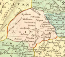
 Ajmer Subah depicted in map of Mughal Empire by Robert Wilkinson (1805) | |||||||||||
| Capital | Ajmer | ||||||||||
| Government | |||||||||||
| Subahdar | |||||||||||
• 1580 | Dastam Khan | ||||||||||
| History | |||||||||||
• Established | 1580 | ||||||||||
• Maratha occupation | 1758 | ||||||||||
| |||||||||||
| Today part of | India | ||||||||||
The Ajmer Subah (Persian: صوبه اجمیر) was one of the original 12 subahs (provinces) that comprised the Mughal Empire after the administrative reform under the rule of Akbar. Its borders roughly corresponded to modern-day Rajasthan, and the capital was the city of Ajmer.[1]
- ^ Chaudhary, S. S. (2000). Ranthambhore Beyond Tigers. Himanshu Publications. p. 48.