Al-Dalhamiyya
الدلهمية | |
|---|---|
Village | |
| Etymology: from a family name[1] | |
A series of historical maps of the area around Al-Dalhamiyya (click the buttons) | |
Location within Mandatory Palestine | |
| Coordinates: 32°39′38″N 35°35′52″E / 32.66056°N 35.59778°E | |
| Palestine grid | 204/230 |
| Geopolitical entity | Mandatory Palestine |
| Subdistrict | Tiberias |
| Date of depopulation | April 15, 1948 |
| Area | |
• Total | 2,852 dunams (2.852 km2 or 1.101 sq mi) |
| Population (1945) | |
• Total | 410[2][3] |
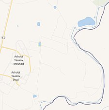
Al-Dalhamiyya (Arabic: الدلهمية) was a Palestinian Arab village in the Tiberias Subdistrict. It was depopulated during the 1947–1948 Civil War in Mandatory Palestine on April 15, 1948, under Operation Gideon. It was located 14 km south of Tiberias, on the north bank of the Yarmuk River, on the border between Mandatory Palestine and Transjordan.


