Al-Salihiyya
الصالحية Salihiya[1] | |
|---|---|
 Al-Salihiyya c. 1936. Woman weaving papyrus mat. | |
| Etymology: This name is elsewhere attached to buildings or establishments founded by Salah ad-Din (Saladin).[2] | |
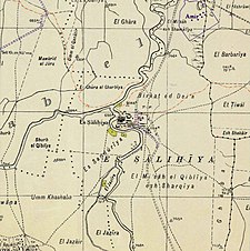
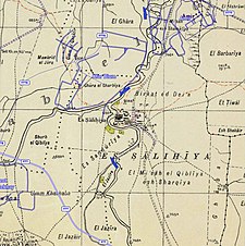
A series of historical maps of the area around Al-Salihiyya (click the buttons) | |
Location within Mandatory Palestine | |
| Coordinates: 33°10′02″N 35°36′45″E / 33.16722°N 35.61250°E | |
| Palestine grid | 207/285 |
| Geopolitical entity | Mandatory Palestine |
| Subdistrict | Safad |
| Date of depopulation | May 25, 1948[1] |
| Population (1945) | |
• Total | 1,520[3][4] |
| Cause(s) of depopulation | Fear of being caught up in the fighting |
| Secondary cause | Whispering campaign |
Al-Salihiyya (Arabic: الصالحية) was a Palestinian Arab village populated by people traditionally associated with the Ghawarna, a generic exonym denoting inhabitants of the drainage plains of the Hula Valley.[5] It was depopulated during the 1948 War on May 25, 1948, by the Israeli Palmach. It was located in the Safad Subdistrict, 25 km northeast of Safad, at the intersection of the Jordan River and Wadi Tur'an.
- ^ a b Morris, 2004, p. xvi, village #15. Also gives causes of depopulation.
- ^ Palmer, 1881, p. 93
- ^ Cite error: The named reference
Hadawi71was invoked but never defined (see the help page). - ^ Department of Statistics, 1945, p. 11
- ^ Sliman Khawalde, Dan Rabinowitz, 'Race from the Bottom of the Tribe That Never Was: Segmentary Narratives Amongst the Ghawarna of Galilee.' Journal of Anthropological Research Vol. 58, No. 2 (Summer, 2002), pp.225-243


