Al-Ula
العلا | |
|---|---|
City | |
| Coordinates: 26°36′31″N 37°55′25″E / 26.60861°N 37.92361°E | |
| Country | |
| Province | Medina Province |
| Government | |
| • Body | Medina Municipality |
| • Governor of al-‘Ulā | Badr bin Abdullah |
| Area | |
• Total | 22,561 km2 (8,711 sq mi) |
| Elevation | 692 m (2,270 ft) |
| Population (2022)[3] | |
• Total | 60,103 |
| • Density | 2.7/km2 (6.9/sq mi) |
| Time zone | UTC+03:00 (AST) |
| Postal Code | (5 digits) |
| Area code | +966 014 |
| HDI (2021) | 0.875[4] – very high |
| Website | www |
| Official name | Hegra Archaeological Site (al-Hijr / Madā ͐ in Ṣāliḥ) |
| Type | Cultural |
| Criteria | ii, iii |
| Designated | 2008 (32nd session) |
| Reference no. | 1293 |
| Region | the Arab States |
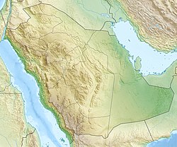
Al-‘Ula (Arabic: ٱلْعُلَا, romanized: al-ʿUlā) is an ancient Arabian oasis city located in Medina Province, Saudi Arabia. Situated in the Hejaz, a region that features prominently in the history of Islam as well as several pre-Islamic Semitic civilizations, al-‘Ulā was a market city on the historic incense route that linked India and the Persian Gulf to the Levant and Europe.[5]
From an archaeological perspective, the immediate vicinity contains a unique concentration of precious artifacts, including well-preserved ancient stone inscriptions that illustrate the development of the Arabic language, and a concentration of rock dwellings and tombs that date from the Nabatean and Dedanite periods that coincided with Greco-Roman influence during classical antiquity. Saudi Arabia's first UNESCO World Heritage Site, Hegra (also known as al-Ḥijr, or Madā'in Ṣaliḥ), is located 22 km (14 miles) north of the city, in al-‘Ulā governorate. Built more than 2,000 years ago by the Nabataeans, Hegra is often compared with its sister city of Petra, in Jordan. Meanwhile, the ancient walled oasian city of al-‘Ulā, locally known as al-Dīrah, situated near the oasis' palm grove that allowed for its settlement, contains a dense cluster of mud-brick and stone houses.[6] al-‘Ulā was also the capital of the ancient Lihyanites (Dedanites).
Today, the city of al-‘Ulā is within the Governorate of al-‘Ulā (Arabic: مُحَافَظَة ٱلْعُلَا, romanized: Muḥāfathat Al-ʿUlā), one of seven constituent counties of Medina province. The city is located 110 km (68 miles) southwest of Tayma and 300 km (190 miles) north of Medina.[7] The city (municipality) covers 2,391 square kilometres (923 sq mi),[8] and has a population of 60,103 as of 2022[update].[9][8] In addition to the ancient old town al-Dīrah, a more recent historical and adjacent settlement, al-Judaydah, displaying the settlement patterns of Arabic-Islamic urbanism, remains occupied and is currently experiencing a redesign. Since the 1980s, the oasis of al-‘Ulā has experienced significant agricultural and urban growth. Since then, the settled Bedouins have been added to the population of Sedentary people and, as in the rest of the kingdom, a large population of immigrant workers.[10]
The area is also known for its striking landscape of rocks, canyons, and wadis, and the contrast between these dry surroundings and the lush, palm-filled oases near the city's centre. The oasis of al-‘Ulā was once a key stop on the Hejaz Railway, linking Damascus to Medina.
- ^ محافظة اللا [Governate of Al-Ula]. Madinah Investments (in Arabic). Retrieved 6 May 2024.
- ^ "Elevation Finder". www.freemaptools.com. Archived from the original on 20 April 2020. Retrieved 14 May 2021.
- ^ "GASTAT Portal" بوابة الهيئة - الصفحة الرئيسية. portal.saudicensus.sa (in Arabic). Archived from the original on 3 October 2023. Retrieved 4 May 2024.
- ^ "Sub-national HDI – Subnational HDI – Global Data Lab". Archived from the original on 3 June 2024. Retrieved 4 May 2024.
- ^ "Heritage Sites in Al-'Ula, Saudi Arabia | ExperienceAlUla.com". experiencealula.com. Retrieved 3 June 2020.[permanent dead link]
- ^ Chowdhury, Arka Roy (16 April 2018). "Saudi Arabia is planning to open the region of Al-'Ula for tourists". The Times of India. Archived from the original on 15 January 2019.
- ^ محافظة العلا في السعودية [Al-Ola Governorate in Saudi Arabia]. موسوعة المحيط [The Encyclopedia of the Ocean]. 11 August 2018. Archived from the original on 1 August 2021. Retrieved 15 January 2019.
- ^ a b العلا.. عروس الجبال.. عاصمة الآثار.. مدينة الأربعين عينًا [Al-ʿUla .. Bride of the mountains .. The capital of monuments .. The city of forty Ain]. Al Madina. 1 December 2013. Archived from the original on 13 January 2018. Retrieved 10 May 2019.
- ^ "Places in Al-'Ulā (Medina Region, Saudi Arabia) - Population Statistics, Charts, Map, Location, Weather and Web Information". www.citypopulation.de. Archived from the original on 3 March 2024. Retrieved 3 March 2024.
- ^ Battesti, Vincent; Marty, Léo (2023). "Bedouins and Sedentaries today in al-'Ulâ (Kingdom of Saudi Arabia): al-diyâr and al-Dîra in the rear-view mirror". Arabian Humanities. 17. doi:10.4000/cy.10103. ISSN 2308-6122.


