Al-Zanghariyya
زُحلق/الزنغرية Zanghariya[1] | |
|---|---|
Village | |
| Etymology: Arab ez Zengharîyeh, the Zengharîyeh Arabs, p.n.[2] | |
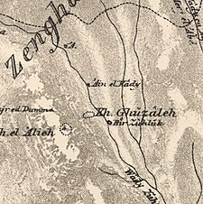
A series of historical maps of the area around Al-Zanghariyya (click the buttons) | |
Location within Mandatory Palestine | |
| Coordinates: 32°56′29″N 35°35′10″E / 32.94139°N 35.58611°E | |
| Palestine grid | 205/260 |
| Geopolitical entity | Mandatory Palestine |
| Subdistrict | Safad |
| Date of depopulation | May 4, 1948[1] |
| Area | |
• Total | 27,918 dunams (27.918 km2 or 10.779 sq mi) |
| Population (1945) | |
• Total | 840[3][4] |
| Cause(s) of depopulation | Military assault by Yishuv forces |
| Secondary cause | Expulsion by Yishuv forces |
| Current Localities | Elifelet[5] |
Al-Zanghariyya was a Palestinian Arab village in the Safad Subdistrict. It was depopulated during the 1947–1948 Civil War in Mandatory Palestine on May 4, 1948, under Operation Matateh. It was located 8.5 km southeast of Safad, near Wadi al-Ghara. The village was later burned and destroyed on June 17, 1948.
- ^ a b Morris, 2004, p. xvii, village #76. Also gives causes of depopulation.
- ^ Palmer, 1881, p. 67
- ^ Department of Statistics, 1945, p. 11
- ^ Government of Palestine, Department of Statistics. Village Statistics, April, 1945. Quoted in Hadawi, 1970, p. 71 Archived 2011-06-04 at the Wayback Machine
- ^ Khalidi, 1992, p. 507


