Al-Fouta
الفوطة | |
|---|---|
 | |
| Coordinates: 24°38′33″N 46°42′33″E / 24.64250°N 46.70917°E | |
| Country | |
| City | Riyadh |
| Named for | Al Fouta Park |
| Government | |
| • Body | Al Malaz Sub-Municipality |
| Area | |
• Total | 1.1145 km2 (0.4303 sq mi) |
| Language | |
| • Official | Arabic |
 | |
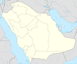
Al-Fouta (Arabic: الفوطة), alternatively transliterated as al-Futah, is a neighborhood in central Riyadh, Saudi Arabia, located south of al-Murabba and north of al-Dirah in the sub-municipality of al-Malaz. It emerged in the 1940s following the construction of the Red Palace for then Saudi crown prince Saud bin Abdulaziz.[1] It popularly hosts the Riyadh Water Tower, one of the notable landmarks in the city as well as the rest of the southern portion of the King Abdulaziz Historical Center, including the eponymous al-Fouta Park.[2][3] As the neighborhood is bounded by al-Batʼha Street to the east, its eastern strip partially forms part of the al-Batʼha commercial area.
The neighborhood is unofficially divided into two sections, Fouta East (Arabic: الفوطة الشرقية) and Fouta West (Arabic: الفوطة الغربية).[4][5]
- ^ Elsheshtawy, Yasser (2008-05-27). The Evolving Arab City: Tradition, Modernity and Urban Development. Routledge. ISBN 978-1-134-12821-1.
- ^ "تسمية الفوطة تسمية محلية.. وفي الرياض العديد من الأحياء نسبت إلى عوائل وأسر". www.al-jazirah.com. Retrieved 2023-01-04.
- ^ "تُعتبر من أقدم الحدائق في مدينة الرياض". www.al-jazirah.com. Retrieved 2023-01-04.
- ^ "بدء أعمال تدعيم المباني التراثية بحي الفوطة في الرياض". www.alriyadh.com (in Arabic). 7 September 2021. Retrieved 29 September 2023.
- ^ Tashkandi, Hala. "Al-Foutas facelift: Riyadhs historical district slated for renovation". www.zawya.com. Retrieved 2023-09-29.

