| Alajuela Formation | |
|---|---|
| Stratigraphic range: Tortonian (Earliest Hemphillian or Latest Clarendonian)[1] | |
| Type | Formation |
| Sub-units | See text |
| Underlies | alluvium |
| Overlies | Caimito Formation |
| Area | 25 km2 (9.7 sq mi)[2] |
| Thickness | >110 m (360 ft) (total) 82 m (269 ft) (composite) |
| Lithology | |
| Primary | Sandstone |
| Other | Limestone, conglomerate |
| Location | |
| Coordinates | 9°12′45″N 79°35′37″W / 9.2124°N 79.5936°W |
| Approximate paleocoordinates | 9°00′N 78°12′W / 9.0°N 78.2°W |
| Region | Panamá Province |
| Country | |
| Extent | Panama Basin |
| Type section | |
| Named for | Lake Alajuela |
| Named by | Woodring |
| Year defined | 1957 |
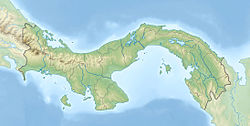
The Alajuela Formation, originally Alhajuela Formation (Tau),[3] is a Late Miocene (Tortonian, Early Hemphillian or Latest Clarendonian in the NALMA classification) geologic formation in the Panama Canal Zone of central Panama.
The formation overlies the Caimito Formation and comprises sandstones, limestones and conglomerates deposited in a tidal-dominated estuarine to shallow marine environment.
The formation crops out in a small area along the southern and western shores of Lake Alajuela, of which it derives its name, and preserves a rich fossil faunal assemblage of mammals, fish (among which fossil teeth of megalodon), invertebrates and flora. The fauna is of paleontological significance as an insight into the ecosystem of Central America preceding the Great American Biotic Interchange (GABI).
- ^ Cite error: The named reference
MacFadden2017_p23was invoked but never defined (see the help page). - ^ Area Calculator
- ^ Geologic Map, 1980
