This article needs additional citations for verification. (November 2016) |
Alathur | |
|---|---|
 Alathur | |
| Coordinates: 10°38′53″N 76°32′18″E / 10.64806°N 76.53833°E | |
| Country | |
| State | Kerala |
| District | Palakkad |
| Government | |
| • Type | Panchayati Raj (India) |
| • Body | Alathur Panchayat |
| Area | |
| • Total | 19.62 km2 (7.58 sq mi) |
| Population (2011)[1] | |
| • Total | 26,720 |
| • Density | 1,361.88/km2 (3,527.3/sq mi) |
| Languages | |
| • Official | Malayalam, English |
| Time zone | UTC+5:30 (IST) |
| PIN | 678541 |
| Telephone code | 04922 |
| Vehicle registration | KL-49 |
| Nearest city | Palakkad |
| Parliament constituency | Alathur |
| Assembly constituency | Alathur |
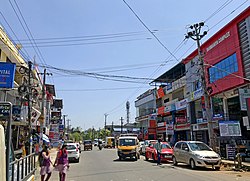
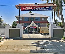
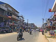
Alathur is a town, taluk and gram panchayat in Palakkad District, Kerala, India.[2] It is the administrative headquarters of the Alathur Taluk and is situated about 24 km from the district headquarters Palakkad through National Highway 544.Gayathripuzha River , one of the tributary of Bharathapuzha, flows through Alathur.[3] Alathur is one among the 20 Parliamentary Constituencies in Kerala.[4] A Mini Civil Station is also located here which provides government related services.[5]


- ^ "Kerala (India): Districts, Cities and Towns - Population Statistics, Charts and Map".
- ^ "Reports of National Panchayat Directory". Ministry of Panchayati Raj. Archived from the original on 30 December 2013. Retrieved 30 December 2013.
- ^ "Gayathripuzha River, India Tourist Information". www.touristlink.com. Retrieved 13 August 2022.
- ^ "Parliamentary constituencies in Kerala and Assembly segmants". keralaassembly.org. Retrieved 13 August 2022.
- ^ Keralam, Digital. "Mini Civil Station Alathur, Palakkad". Digital Keralam. Retrieved 5 September 2022.

