Albert County | |
|---|---|
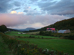
 Farm landscape near Alma | |
 Location within New Brunswick | |
| Coordinates: 45°49′N 64°51′W / 45.82°N 64.85°W | |
| Country | Canada |
| Province | New Brunswick |
| Established | 1845 |
| Area | |
| • Land | 1,807.88 km2 (698.03 sq mi) |
| Population (2016)[1] | |
• Total | 29,158 |
| • Density | 16.1/km2 (42/sq mi) |
| • Pop 2011-2016 | |
| • Dwellings | 13,111 |
| Time zone | UTC-4 (AST) |
| • Summer (DST) | UTC-3 (ADT) |
| Area code | 506 |
Wikimedia Commons has media related to Albert County, New Brunswick.
Albert County (2016 population 29,158)[1] is New Brunswick's third-youngest county, located on the Western side of the Petitcodiac River on the Chignecto Bay in the Bay of Fundy; the shire town is Hopewell Cape. The county was established in 1845 from parts of Westmorland County and Saint John County, and named after Prince Albert.[2] Since the abolition of county municipal governments in 1967, its best-known use is as a census division.
The mineral albertite was discovered a few miles away in 1849, giving rise to Albert Mines.[3]
- ^ a b c "Census Profile, 2016 Census Albert, County, New Brunswick". Statistics Canada. Retrieved September 3, 2019.
- ^ Hamilton, William Baillie (1996). Place Names of Atlantic Canada. University of Toronto Press. p. 43. ISBN 0-8020-7570-3.
- ^ Hamilton, William (1978). The Macmillan Book of Canadian Place Names. Toronto: Macmillan. p. 70. ISBN 0-7715-9754-1.