| Northern Woods and Water Route | ||||
 | ||||
| Route information | ||||
| Maintained by the Ministry of Transportation and Economic Corridors | ||||
| Length | 263 km[1] (163 mi) | |||
| Major junctions | ||||
| West end | ||||
| East end | ||||
| Location | ||||
| Country | Canada | |||
| Province | Alberta | |||
| Specialized and rural municipalities | Athabasca County, Lac La Biche County, Bonnyville No. 87 M.D. | |||
| Major cities | Cold Lake | |||
| Towns | Athabasca | |||
| Highway system | ||||
|
| ||||
| ||||
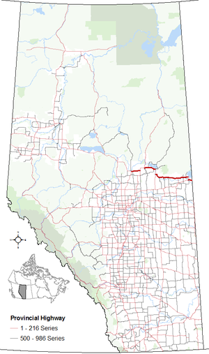
Alberta Provincial Highway No. 55, commonly referred to as Highway 55, is a 263-kilometre (163 mi) long east–west highway in northeast Alberta, Canada.[2] It extends from the Saskatchewan border in the east through the Cold Lake, Lac La Biche, and Athabasca where it ends at Highway 2. In Saskatchewan, it continues as Saskatchewan Highway 55.[3][1]
The entire length of Highway 55 comprises the easternmost segment of Alberta's portion of the Northern Woods and Water Route (NWWR). West of Athabasca, the Northern Woods and Water Route continues westward along Highway 2 and then Highway 49.
- ^ a b "Highway 55 in Alberta" (Map). Google Maps. Retrieved 2017-12-14.
- ^ Provincial Highways Designation Order, Alberta Transportation, p. 8
- ^ "2015 Provincial Highway 1-216 Progress Chart" (PDF). Alberta Transportation. March 2015. Archived (PDF) from the original on 2016-04-10. Retrieved 2016-10-31.

