| Banff-Windermere Highway Icefields Parkway | ||||
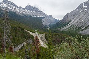
 Highway 93 as seen from the observation deck on the north side of Parker Ridge. | ||||
| Route information | ||||
| Maintained by the Ministry of Transportation and Economic Corridors | ||||
| Length | 268 km (167 mi) | |||
| Existed | 1940–present | |||
| Restrictions | No commercial vehicles and National Parks pass required along the Icefields Parkway. Snow tires or chains required Nov. 1 to Mar. 31. | |||
| Major junctions | ||||
| South end | ||||
| North end | ||||
| Location | ||||
| Country | Canada | |||
| Province | Alberta | |||
| Specialized and rural municipalities | I.D. No. 9, I.D. No. 12, Jasper | |||
| Highway system | ||||
|
| ||||
| ||||
Highway 93 is a north–south highway in Alberta, Canada. It is also known as the Banff-Windermere Parkway south of the Trans-Canada Highway (Highway 1) and the Icefields Parkway north of the Trans-Canada Highway. It travels through Banff National Park and Jasper National Park and is maintained by Parks Canada for its entire length.[1] It runs from the British Columbia border at Vermilion Pass in the south, where it becomes British Columbia Highway 93, to its terminus at the junction with the Yellowhead Highway (Highway 16) at Jasper.[2] The route takes its number from U.S. Route 93, which runs uninterrupted south to central Arizona, and was initially designated as '93' in 1959.
- ^ "Internal Audit and Evaluation Documents: Evaluation of Parks Canada's Through Highway Management". Parks Canada. November 22, 2010. Archived from the original on May 14, 2016. Retrieved June 22, 2016.
- ^ Alberta Official Road Map (Map) (2015 ed.). City of Edmonton Transportation Services for Alberta Culture and Tourism. § J–2, K–3, L–3, and L–4.

