Albina | |
|---|---|
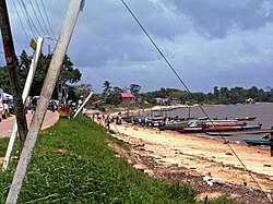
 Albina in 2008 | |
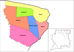
 Map showing the resorts of Marowijne District. Albina | |
| Coordinates: 5°30′N 54°03′W / 5.500°N 54.050°W | |
| Country | |
| District | Marowijne District |
| Resort (municipality) | Albina |
| Area | |
| • Total | 397 km2 (153 sq mi) |
| Elevation | 5 m (16 ft) |
| Population (2012 census)[1] | |
| • Total | 5,247 |
| • Density | 13/km2 (34/sq mi) |
Albina is a town in eastern Suriname, and is capital of the Marowijne District. The town lies on the west bank of the Marowijne river (Maroni river), which forms the border with French Guiana, directly opposite the French Guianan town of Saint-Laurent-du-Maroni, to which it is connected by a frequent ferry service. Albina can be reached by bus via the East-West Link. The distance between Paramaribo and Albina is about 150 kilometres (95 mi).[2]
- ^ "Resorts in Suriname Census 2012" (PDF). Retrieved 19 May 2020.
- ^ "Transport". Ministry of Transport, Communication and Tourism (in Dutch). Archived from the original on 30 May 2012. Retrieved 19 May 2020.