This article needs additional citations for verification. (September 2015) |
Alipurduar | |
|---|---|
City | |
 Alipurduar (The Queen of the Dooars) | |
| Coordinates: 26°29′20″N 89°31′37″E / 26.489°N 89.527°E | |
| Country | India |
| State | West Bengal |
| District | Alipurduar |
| Government | |
| • Type | Municipality |
| • Body | Alipurduar Municipality |
| • Chairperson | Prasenjit Kar (AITC)[1] |
| Area | |
• Total | 8.98 km2 (3.47 sq mi) |
| Elevation | 93 m (305 ft) |
| Population (2011)[3] | |
• Total | 127,342 |
| • Density | 14,000/km2 (37,000/sq mi) |
| Languages | |
| • Official | Bengali |
| Time zone | UTC+5:30 (IST) |
| PIN | 736121, 736122 & 736123 |
| Telephone code | 03564 |
| ISO 3166 code | IN-WB |
| Vehicle registration | WB-70/WB-69 |
| Lok Sabha constituency | Alipurduars (ST) (Manoj Tigga as MP) |
| Vidhan Sabha constituency | Alipurduars (Suman Kanjilal as MLA) |
| Website | www |
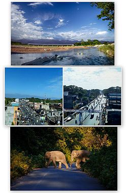
Alipurduar is a city and a municipality in the Indian state of West Bengal. It is the headquarters of the Alipurduar district. Situated on the east bank of Kaljani River in the foothills of the Himalayas, the city is a gateway to Bhutan and the northeastern states of India. Alipurduar was a sub-divisional town of Jalpaiguri district until 2014 when it was created a separate district.
- ^ "Alipurduar News- আলিপুরদুয়ার পৌরসভার চেয়ারম্যান পদে শপথ নিলেন প্রসেনজিত্ কর". Dpendra Nath Lahiri. 22 March 2022. Retrieved 22 March 2022.
- ^ "Alipurduar City". 22 November 2017.
- ^ Cite error: The named reference
2011 censuswas invoked but never defined (see the help page).

