Allen County | |
|---|---|
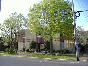
 Allen County Courthouse in Scottsville | |
 Location within the U.S. state of Kentucky | |
 Kentucky's location within the U.S. | |
| Coordinates: 36°45′N 86°11′W / 36.75°N 86.19°W | |
| Country | |
| State | |
| Founded | 1815 |
| Named for | John Allen |
| Seat | Scottsville |
| Largest city | Scottsville |
| Area | |
• Total | 352 sq mi (910 km2) |
| • Land | 344 sq mi (890 km2) |
| • Water | 7.5 sq mi (19 km2) 2.1% |
| Population (2020) | |
• Total | 20,588 |
• Estimate (2023) | 21,788 |
| • Density | 58/sq mi (23/km2) |
| Time zone | UTC−6 (Central) |
| • Summer (DST) | UTC−5 (CDT) |
| Congressional district | 1st |
| Website | www |
Allen County is a county located in the U.S. state of Kentucky. As of the 2020 census, the population was 20,588.[1] Its county seat and only municipality is Scottsville.[2] The county is named for Colonel John Allen, a state senator and soldier who was killed leading the 1st Regiment of Kentucky Rifleman at the Battle of Frenchtown, Michigan during the War of 1812.[3] Allen County was a dry county until 2023, when it voted to legalize the sale of alcohol.[4] It was formed in 1815 from parts of Barren and Warren counties. Allen County is included in the Bowling Green, KY Metropolitan Statistical Area.
- ^ "State & County QuickFacts". United States Census Bureau. Retrieved September 8, 2022.
- ^ "Find a County". National Association of Counties. Archived from the original on May 31, 2011. Retrieved June 6, 2011.
- ^ The Register of the Kentucky State Historical Society, Volume 1. Kentucky State Historical Society. 1903. pp. 34.
- ^ Parham, Derek (May 17, 2023). "Prohibition comes to an end in Allen County with wet/dry decision". www.wbko.com. Retrieved October 31, 2023.