Almora district | |
|---|---|
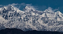
Clockwise from top-left: Jageshwar, Almora town, Binsar Wildlife Sanctuary, Nanda Devi from Ranikhet, Surya temple Katarmal | |
 Location in Uttarakhand | |
| Coordinates: 29°35′50″N 79°39′25″E / 29.59718°N 79.6570°E | |
| Country | |
| State | Uttarakhand |
| Division | Kumaon |
| Headquarters | Almora |
| Government | |
| • District collector | Vineet Tomar IAS[1] |
| Area | |
• Total | 3,082 km2 (1,190 sq mi) |
| Elevation | 1,646 m (5,400 ft) |
| Population (2011) | |
• Total | 622,506 |
| • Density | 200/km2 (500/sq mi) |
| Time zone | UTC+5:30 (IST) |
| PIN | 263601 |
| Telephone code | 91-5962 |
| Vehicle registration | UK-01 |
| Climate | Alpine (BSh) and Humid subtropical(Bsh) (Köppen) |
| Annual temperature | 28 to -2 °C |
| Summer temperature | 28 - 12 °C |
| Winter temperature | 15 to -2 °C |
| Website | almora |
Almora is a district in the Kumaon Division of Uttarakhand state, India. The headquarters is at Almora. It is 1,638 meters above sea level. The neighbouring regions are Pithoragarh district to the east, Chamoli district to the west, Bageshwar district to the north and Nainital district to the south.
- ^ "DM Profile | District Almora, Government of Uttarakhand | India". Retrieved 4 July 2023.


