| Alvand | |
|---|---|
 | |
| Highest point | |
| Elevation | 3,580 m (11,750 ft)[1] |
| Prominence | 1,654 m (5,427 ft)[1] |
| Listing | Ultra |
| Coordinates | 34°39′51″N 48°29′12″E / 34.66417°N 48.48667°E[1] |
| Geography | |
| Location | Hamedan, Iran |
| Parent range | Zagros Mountains |

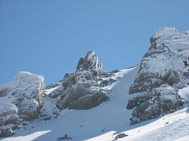
Alvand is a subrange of the Zagros Mountains in western Iran located 10 km (6.2 miles) south of the city of Hamadan in Hamadan Province. Its summit has an elevation of 3,580 m (11,750 ft).[2] The main body of the Alvand range extends for about 50 km from east to west, while their maximum north-south width is about 30 km.[2] Formed as part of the Zagros orogeny in the late Jurassic and early Cretaceous, the mountains rise sharply from the surrounding plains and are scored by many deep valleys.[2] The mountains are mostly granite and diorite, which are types of intrusive rock.[2]
The area was once covered by a light oak forest,[2] but extensive deforestation in historical times has reduced this to only a small area, mostly in the valleys.[3] Today, the higher altitudes have a sparse cover of grass, while grass cover grows more thickly around springs and streams.[2] One important plant that commonly grows in the Alvand valleys is the gavar or goat's thorn, which produces the gum known as tragacanth which is used in medicine and industry.[3]
Although no settlements exist on the mountains themselves, the valleys and surrounding plains are home to many towns and villages.[2] Several major cities lie at the foot of the Alvand range, including Hamadan, Malayer, and Tuyserkan.[2] These settlements are supported by a highly productive agricultural base which includes wheat growing and livestock breeding (sheep, goats, and cattle).[2] This agricultural prosperity comes from the combination of a favorable highland climate and an abundance of water flowing down from the Alvand mountains.[2]
The historic site of Ganj Nameh, where two trilingual inscriptions were left in Achaemenid times, is located at the foot of the Alvand mountains, 10 km south of Hamadan.[2] The Alvand range forms a language border between Turkish, Kurdish, Persian, and Luri.[2]
- ^ a b c "Iran - 54 Mountain Summits with Prominence of 1,500 meters or greater". Peaklist.org. Retrieved 2013-02-09.
- ^ a b c d e f g h i j k l Ehlers, E. "ALVAND KŪH". Encyclopaedia Iranica. Retrieved 12 October 2022.
- ^ a b Adka'i, Parviz. "HAMADĀN i. GEOGRAPHY". Encyclopaedia Iranica. Retrieved 12 October 2022.
