| Amaroo Canberra, Australian Capital Territory | |||||||||||||||
|---|---|---|---|---|---|---|---|---|---|---|---|---|---|---|---|
 | |||||||||||||||
| Coordinates | 35°10′17″S 149°7′44″E / 35.17139°S 149.12889°E | ||||||||||||||
| Population | 6,129 (SAL 2021)[1] | ||||||||||||||
| Established | 1994 | ||||||||||||||
| Postcode(s) | 2914 | ||||||||||||||
| Elevation | 638 m (2,093 ft) | ||||||||||||||
| Area | 2.6 km2 (1.0 sq mi) | ||||||||||||||
| Location |
| ||||||||||||||
| District | Gungahlin | ||||||||||||||
| Territory electorate(s) | Yerrabi | ||||||||||||||
| Federal division(s) | Fenner | ||||||||||||||
| |||||||||||||||
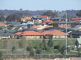
Amaroo (/ˈæməruː/) is a suburb in the Canberra, Australia district of Gungahlin and was gazetted on 18 October 1991. Amaroo means 'a beautiful place' in Nyoongar.[2] Place names in Amaroo such as Shoalhaven Avenue are named after Australian rivers and lakes. Amaroo is adjacent to the suburbs of Ngunnawal, Gungahlin, Moncrieff, Forde, Bonner and Jacka. The suburb is bounded by Mirrabei Drive and Horse Park Drive and Gundaroo Drive. The suburb is located approximately 14 km from the Gungahlin Town Centre and 15 km from the centre of Canberra.
- ^ Australian Bureau of Statistics (28 June 2022). "Amaroo (ACT) (suburb and locality)". Australian Census 2021 QuickStats. Retrieved 28 June 2022.
- ^ "History of Amaroo Village". www.amaroovillage.com.au. Retrieved 3 June 2022.
