Amawan
Amāwān | |
|---|---|
Village | |
 Map of Amawan CD block | |
| Coordinates: 26°18′45″N 81°20′56″E / 26.312476°N 81.348951°E[1] | |
| Country India | |
| State | Uttar Pradesh |
| District | Raebareli |
| Area | |
• Total | 5.838 km2 (2.254 sq mi) |
| Population (2011)[2] | |
• Total | 5,245 |
| • Density | 900/km2 (2,300/sq mi) |
| Languages | |
| • Official | Hindi |
| Time zone | UTC+5:30 (IST) |
| Vehicle registration | UP-36 |
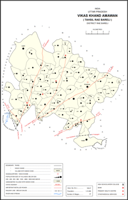
Amawan is a village and corresponding community development block in Rae Bareli district, Uttar Pradesh, India.[2] It historically was the seat of a taluqdari estate held by a Pathan family and eventually split into two shares.[3] As of 2011, its population is 5,245, in 973 households.[2] It has 5 primary schools and a community health centre,a veterinary hospital and 2 Bank 1 Baroda purvi Uttar Pradesh and UCO bank and a post office and a ancient Shiv temple name Shree Jharkhandeshwar.[2]
- ^ "Geographic Names Search WebApp". Search for "Amawan" here.
- ^ a b c d e "Census of India 2011: Uttar Pradesh District Census Handbook - Rae Bareli, Part A (Village and Town Directory)" (PDF). Census 2011 India. pp. 185–201. Retrieved 4 August 2021.
- ^ Nevill, H.R. (1905). Rai Bareli: A Gazetteer, Being Volume XXXIX Of The District Gazetteers Of The United Provinces Of Agra And Oudh. Allahabad: Government Press. pp. 97–8. Retrieved 4 August 2021.
