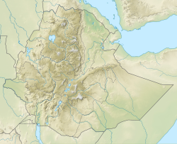
| Amba Aradam Formation | |
|---|---|
| Stratigraphic range: Early Aptian ~ | |
 Cliff and waterfall at Dingilet, Mika’el Abiy tabia | |
| Type | Geological formation |
| Sub-units | Graua Limestone member |
| Underlies | Tertiary basalts |
| Overlies | Agula Shale, Mugher Mudstone |
| Thickness | 200 m (660 ft) |
| Lithology | |
| Primary | Sandstone, siltstone |
| Other | Claystone, conglomerates, iron oxide |
| Location | |
| Coordinates | 13°19′41″N 39°26′17″E / 13.328°N 39.438°E |
| Approximate paleocoordinates | 15°12′S 28°30′E / 15.2°S 28.5°E |
| Region | Tigray |
| Country | |
| Extent | northern Ethiopian Highlands |
| Type section | |
| Named for | Imba Aradom mountain, near Hintalo |
| Named by | William Thomas Blanford |
| Year defined | 1868 |
The Amba Aradam Formation is a Cretaceous sandstone formation in Ethiopia. It is up to 200 metres thick, for instance in the Degua Tembien district.[1] As fossils are absent, the age of the Amba Aradam Formation was interpreted based on the age of assumed corresponding sandstones elsewhere in Ethiopia:[1] the Debre Libanos Sandstones in the Blue Nile Basin, and the Upper Sandstone near Harrar in southeast Ethiopia, both of Late Cretaceous age (100–66 million years ago).[2][3][4] The lithology of the Amba Aradam Formation makes it less suitable for rock church excavation; caves have however been blasted in this formation to serve as headquarters for the TPLF during the Ethiopian Civil War of the 1980s.[1]
- ^ a b c Bussert, R. (2019). Rock-Hewn Sandstone Churches and Man-Made Caves in and Around Dogu'a Tembien. In: Geo-trekking in Ethiopia's Tropical Mountains - The Dogu'a Tembien District. Cham (CH): SpringerNature. doi:10.1007/978-3-030-04955-3_8.
- ^ Sembroni, A.; Molin, P.; Dramis, F. (2019). Regional geology of the Dogu'a Tembien massif. In: Geo-trekking in Ethiopia's Tropical Mountains - The Dogu'a Tembien District. SpringerNature. ISBN 978-3-030-04954-6.
- ^ Bosellini, A.; Russo, A.; Fantozzi, P.; Assefa, G.; Tadesse, S. (1997). "The Mesozoic succession of the Mekelle Outlier (Tigrai Province, Ethiopia)". Mem. Sci. Geol. 49: 95–116.
- ^ Bussert, R.; Dawit Enkurie (2009). "Unexpected diversity: New results on the stratigraphy and sedimentology of Palaeozoic and Mesozoic siliciclastic sediments in Northern Ethiopia". Zentralbl Geol Paläontol. 3/4: 181–198.
