Amenia, North Dakota | |
|---|---|
 Amenia, North Dakota | |
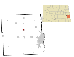
 Location of Amenia, North Dakota | |
| Coordinates: 47°0′14″N 97°13′23″W / 47.00389°N 97.22306°W | |
| Country | United States |
| State | North Dakota |
| County | Cass |
| Founded | 1880 |
| Government | |
| • Mayor | Tony Roth |
| Area | |
| • Total | 1.49 sq mi (3.86 km2) |
| • Land | 1.49 sq mi (3.86 km2) |
| • Water | 0.00 sq mi (0.00 km2) |
| Elevation | 958 ft (292 m) |
| Population | |
| • Total | 85 |
| • Estimate (2022)[4] | 85 |
| • Density | 57.09/sq mi (22.04/km2) |
| Time zone | UTC-6 (Central (CST)) |
| • Summer (DST) | UTC-5 (CDT) |
| ZIP code | 58004 |
| Area code | 701 |
| FIPS code | 38-01940 |
| GNIS feature ID | 1035908[2] |
| Website | www |
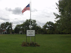
Amenia (/əˈmiːniə/ ə-MEE-nee-ə) is a city in Cass County, North Dakota, United States. The population was 85 at the 2020 census.[3] Amenia was founded in 1880.
The town is the site of several transmitter towers of Fargo broadcast television and radio stations.
Amenia was the home of North Dakota governor William L. Guy before and after holding office.
- ^ "ArcGIS REST Services Directory". United States Census Bureau. Retrieved September 20, 2022.
- ^ a b U.S. Geological Survey Geographic Names Information System: Amenia, North Dakota
- ^ a b "Explore Census Data". United States Census Bureau. Retrieved November 29, 2023.
- ^ Cite error: The named reference
USCensusEst2022was invoked but never defined (see the help page).