This article possibly contains original research. (November 2010) |
| Amlwch | |
|---|---|
 Amlwch Port | |
Location within Anglesey | |
| Area | 18.19 km2 (7.02 sq mi) |
| Population | 3,789 (2011) |
| • Density | 208/km2 (540/sq mi) |
| OS grid reference | SH4492 |
| Community |
|
| Principal area | |
| Preserved county | |
| Country | Wales |
| Sovereign state | United Kingdom |
| Post town | AMLWCH |
| Postcode district | LL68 |
| Dialling code | 01407 |
| Police | North Wales |
| Fire | North Wales |
| Ambulance | Welsh |
| UK Parliament | |
| Senedd Cymru – Welsh Parliament | |
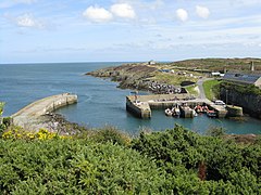
Amlwch (Welsh: [ˈamlʊχ]) is a port town and community in Wales. It is situated on the north coast of the Isle of Anglesey, on the A5025 which connects it to Holyhead and to Menai Bridge. As well as Amlwch town and Amlwch Port, other settlements within the community include Burwen, Bull Bay (Porthllechog) and Pentrefelin. The town has a beach in Llaneilian, and it has significant coastal cliffs. Tourism is an important element of the local economy. At one time it was a booming mining town that became the centre of a vast global trade in copper ore. The harbour inlet became a busy port and significant shipbuilding and ship repair centre, as well as an embarkation point with boats sailing to the Isle of Man and to Liverpool. The community covers an area of about 15 square kilometres.[1]
- ^ UK Census (2011). "Local Area Report – Amlwch Parish (W04000002)". Nomis. Office for National Statistics. Retrieved 25 August 2020.


