This article needs additional citations for verification. (September 2018) |
This article's factual accuracy is disputed. (January 2017) |
Ampati | |
|---|---|
Town | |
| Coordinates: 25°28′15″N 89°56′04″E / 25.470728°N 89.934529°E | |
| Country | India |
| State | Meghalaya |
| District | South West Garo Hills |
| District council | GHADC |
| Languages | |
| • Regional | Garo, Koch, Hajong, Bengali |
| Time zone | UTC+5:30 (IST) |
| PIN | 794115 |
| Vehicle registration | ML 14 |
| Website | southwestgarohills |
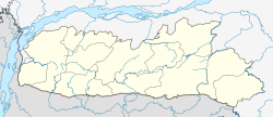
Ampati is a district headquarters of South West Garo Hills of Meghalaya state in north-eastern India.[1] South West Garo Hills is curved of present West Garo Hills on 7 August 2012. It is located at the latitude of 25º27.505 and longitude of 089º56.456 and is 52 km away from the district headquarters Tura of West Garo Hills district, Meghalaya. The hill region is mostly inhabited by the Garos, while in the foothills there are Hajongs and Koches. The second largest ethnicity after Garos is Hajong. The district is surrounded by South Salmara district of Assam and Kurigram District of Bangladesh. South West Garo Hills has approximately 35 kilometres of international boundary with Bangladesh on the south and western side. Nearly one third of the total number of villages of the district is declared as border villages by the Border Area Development Department.
- ^ Civil Sub-divisions Archived 24 March 2013 at the Wayback Machine, West Garo Hills District Administration

