Anabarsky District
Анабарский улус | |
|---|---|
| Other transcription(s) | |
| • Yakut | Анаабыр улууhа |
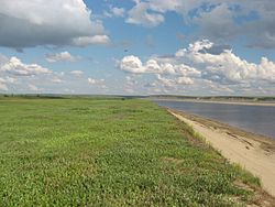
 Anabar River, Anabarsky District | |
 Location of Anabarsky District in the Sakha Republic | |
| Coordinates: 72°07′N 114°21′E / 72.117°N 114.350°E | |
| Country | Russia |
| Federal subject | Sakha Republic[1] |
| Established | December 30, 1930[2] |
| Administrative center | Saskylakh[2] |
| Area | |
| • Total | 55,600 km2 (21,500 sq mi) |
| Population | |
| • Total | 3,501 |
| • Estimate (January 2016)[4] | 3,431 |
| • Density | 0.063/km2 (0.16/sq mi) |
| • Urban | 0% |
| • Rural | 100% |
| Administrative structure | |
| • Administrative divisions | 3 Rural okrugs |
| • Inhabited localities[2] | 3 rural localities |
| Municipal structure | |
| • Municipally incorporated as | Anabarsky Municipal District[5] |
| • Municipal divisions[6] | 0 urban settlements, 2 rural settlements |
| Time zone | UTC+9 (MSK+6 |
| OKTMO ID | 98610000 |
Anabarsky District (Russian: Анаба́рский улу́с; Yakut: Анаабыр улууһа, Anaabır uluuha, IPA: [anaːbɯɾ uluːha]) is an administrative[1] and municipal[5] district (raion, or ulus), one of the thirty-four in the Sakha Republic, Russia. It is located in the northwest of the republic and borders with Bulunsky District in the east, Olenyoksky District in the south, and with Taymyrsky Dolgano-Nenetsky District of Krasnoyarsk Krai in the west. The area of the district is 55,600 square kilometers (21,500 sq mi).[2] Its administrative center is the rural locality (a selo) of Saskylakh.[2] As of the 2010 Census, the total population of the district was 3,501, with the population of Saskylakh accounting for 66.2% of that number.[3]
| Year | Pop. | ±% |
|---|---|---|
| 1970 | 1,906 | — |
| 1979 | 2,161 | +13.4% |
| 1989 | 3,903 | +80.6% |
| 2002 | 4,024 | +3.1% |
| 2010 | 3,501 | −13.0% |
| 2021 | 3,479 | −0.6% |
| Source: Census data | ||
- ^ a b Constitution of the Sakha Republic, Article 45
- ^ a b c d e f Registry of the Administrative-Territorial Divisions of the Sakha Republic
- ^ a b Russian Federal State Statistics Service (2011). Всероссийская перепись населения 2010 года. Том 1 [2010 All-Russian Population Census, vol. 1]. Всероссийская перепись населения 2010 года [2010 All-Russia Population Census] (in Russian). Federal State Statistics Service.
- ^ Sakha Republic (Yakutia) Territorial Branch of the Federal State Statistics Service. Численность населения по районам республики на 1 января 2016 года Archived September 29, 2018, at the Wayback Machine Population of the districts of the republic on January 1, 2016 (in Russian)
- ^ a b Law #172-Z #351-III
- ^ Law #173-Z #354-III
- ^ "Об исчислении времени". Официальный интернет-портал правовой информации (in Russian). June 3, 2011. Retrieved January 19, 2019.

