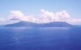
 US Geological Survey photo of Anatahan | |
 | |
| Geography | |
|---|---|
| Location | Pacific Ocean |
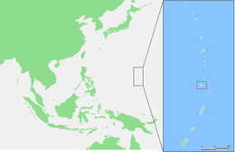
| Coordinates | 16°21′5″N 145°40′43″E / 16.35139°N 145.67861°E |
| Archipelago | Northern Mariana Islands |
| Area | 33.91 km2 (13.09 sq mi)[1] |
| Length | 9 km (5.6 mi) |
| Width | 4 km (2.5 mi) |
| Highest elevation | 790 m (2590 ft) |
| Administration | |
United States | |
| Commonwealth | Northern Mariana Islands |
| Demographics | |
| Population | - uninhabited - (2010) |
Anatahan is a volcanic island in the Northern Mariana Islands in the Pacific Ocean, and has one of the most active volcanoes of the archipelago. Although formerly inhabited, the island is currently uninhabited due to the constant danger of volcanic eruptions. Anatahan is located 60 kilometers (32 nmi) northwest of Farallon de Medinilla and 120 km (65 nmi) north of Saipan. It last erupted between 2007 and 2008, and also erupted in 2003.
Anatahan is the site of a curious WW2 tale in which about 30 Japanese soldiers stayed here, holding out until 1951 before surrendering; during that time they lived with a local woman until 1950. Afterwards, the island was inhabited until 1990 when an earthquake struck leading to its evacuation.
| Anatahan | |
|---|---|
 Ash from Anatahan, June 2005 | |
| Highest point | |
| Elevation | 790 m (2,590 ft)[2][3] |
| Listing | Volcanoes of the Northern Mariana Islands |
| Coordinates | 16°21′N 145°40′E / 16.35°N 145.67°E[2] |
| Geography | |
 | |
| Location | Northern Mariana Islands, Pacific Ocean |
| Geology | |
| Mountain type | Stratovolcano |
| Last eruption | 2007 – 2008 |
- ^ "9 ANATAHAN" (PDF). National Oceanic and Atmospheric Administration. p. 36. Archived (PDF) from the original on 15 November 2020. Retrieved 15 November 2020.
- ^ a b "Anatahan". Global Volcanism Program. Smithsonian Institution. Retrieved 2023-06-10.
- ^ "Topographic map of Anatahan". opentopomap.org. Retrieved 2023-06-10.