| Anderson Marsh State Historic Park | |
|---|---|
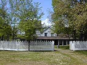
 The Ranch House at Anderson Marsh State Historic Park | |
| Location | Lake County, California, United States |
| Nearest city | Clearlake, California |
| Coordinates | 38°55′25″N 122°37′30″W / 38.92361°N 122.62500°W |
| Area | 1,298 acres (5.25 km2) |
| Established | 1982 |
| Governing body | California Department of Parks and Recreation |
Anderson Marsh State Historic Park is a California State Historic Park and nature reserve preserving a tule marsh, archaeological sites of the Pomo people, and historic ranch structures.[1] It is located in Lake County, California, United States.[2] Anderson Marsh is located at the head of Cache Creek on the southeast corner of Clear Lake, the largest natural lake completely within the borders of California.[2] The park is between the cities of Lower Lake and Clearlake on State Route 53, north of Calistoga in the wine country.[3] The park is open year-round.[4]
- ^ https://www.academia.edu/4136675/Pipe_Dreams_Timeline_of_Events_Leading_to_Anderson_Marsh_State_Historic_Park six-year outline of how the park was acquired.
- ^ a b California, California State Parks, State of. "Anderson Marsh SHP". CA State Parks.
{{cite web}}: CS1 maint: multiple names: authors list (link) - ^ "Anderson Marsh State Historic Park". WhatsYour20. Archived from the original on 2007-09-28. Retrieved 2009-05-22.
- ^ "Anderson Marsh State Historic Park". Go-california.com. Retrieved 2009-05-22.

