Angel Fire, New Mexico | |
|---|---|
Village | |
 Village of Angel Fire | |
| Motto: "Reach New Heights" | |
 Location of Angel Fire, New Mexico | |
| Coordinates: 36°22′44″N 105°17′08″W / 36.37889°N 105.28556°W | |
| Country | United States |
| State | New Mexico |
| County | Colfax |
| Established | 1982 |
| Incorporated | 1986[1] |
| Government | |
| • Mayor | BJ Lindsey [citation needed] |
| Area | |
• Total | 28.84 sq mi (74.71 km2) |
| • Land | 28.80 sq mi (74.61 km2) |
| • Water | 0.04 sq mi (0.10 km2) |
| Elevation | 8,882 ft (2,707 m) |
| Population | |
• Total | 1,192 |
| • Density | 41.38/sq mi (15.98/km2) |
| Time zone | UTC-7 (Mountain (MST)) |
| • Summer (DST) | UTC-6 (MDT) |
| ZIP code | 87710 |
| Area code | 575 |
| FIPS code | 35-03400 |
| GNIS feature ID | 2413529[3] |
| Website | www |
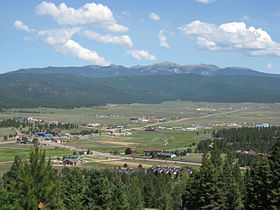
Angel Fire is a village in Colfax County, New Mexico, United States. The population was 1,192 at the 2020 census.[5] Angel Fire Resort is a popular skiing and snowboarding destination, with over 500 acres (2.0 km2) of slopes.[6] Angel Fire and nearby communities experience cold winter temperatures and mild temperatures in the summer.
To the north, off of U.S. Route 64, is Vietnam Veterans Memorial State Park. Angel Fire is on the Enchanted Circle Scenic Byway.
- ^ "Angel Fire Fast Facts". Archived from the original on November 23, 2007. Retrieved September 22, 2007.
- ^ "ArcGIS REST Services Directory". United States Census Bureau. Retrieved October 12, 2022.
- ^ a b U.S. Geological Survey Geographic Names Information System: Angel Fire, New Mexico
- ^ Cite error: The named reference
USCensusDecennial2020CenPopScriptOnlywas invoked but never defined (see the help page). - ^ "Explore Census Data". data.census.gov. Retrieved September 4, 2024.
- ^ "Angel Fire Resort Ski Resort Area Overview - OnTheSnow". www.onthesnow.com. Retrieved September 4, 2024.
