Ankenes Municipality
Ankenes herred | |
|---|---|
 View of the old Ankenes Herredshus (municipal government building) | |
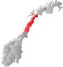
 Nordland within Norway | |
 Ankenes within Nordland | |
| Coordinates: 68°25′16″N 17°22′11″E / 68.42111°N 17.36972°E | |
| Country | Norway |
| County | Nordland |
| District | Ofoten |
| Established | 1 Jan 1884 |
| • Preceded by | Ofoten Municipality |
| Disestablished | 1 Jan 1974 |
| • Succeeded by | Narvik Municipality |
| Administrative centre | Ankenesstrand |
| Government | |
| • Mayor (1972–1973) | Edgar Sneve (Ap) |
| Area (upon dissolution) | |
• Total | 2,028 km2 (783 sq mi) |
| • Rank | #31 in Norway |
| Highest elevation | 1,893.7 m (6,212.9 ft) |
| Population (1973) | |
• Total | 7,025 |
| • Rank | #139 in Norway |
| • Density | 3.5/km2 (9/sq mi) |
| • Change (10 years) | |
| Demonym | Ankenesværing[2] |
| Official language | |
| • Norwegian form | Neutral[3] |
| Time zone | UTC+01:00 (CET) |
| • Summer (DST) | UTC+02:00 (CEST) |
| ISO 3166 code | NO-1855[5] |
Ankenes is a former municipality in Nordland county, Norway. The 2,028-square-kilometre (783 sq mi) municipality existed from 1884 until 1974. It encompassed most of the present-day Narvik Municipality, surrounding of the town of Narvik which was once its own municipality. The administrative centre of Ankenes was the village of Ankenesstrand, situated along the west side of the Beisfjorden, where the Ankenes Church is located.[6][7]


Prior to its dissolution on 1 January 1974, the 2,028-square-kilometre (783 sq mi) municipality was the 31st largest by area out of the 444 municipalities in Norway. Ankenes Municipality was the 139th most populous municipality in Norway with a population of about 7,025. The municipality's population density was 3.5 inhabitants per square kilometre (9.1/sq mi) and its population had increased by 15.7% over the previous 10-year period.[8][9]
Today, the name Ankenes is often used to refer to the suburban Ankenesstrand area, just west of the centre of the town of Narvik. The European route E6 highway is the main thoroughfare through Ankenesstrand and it follows the shoreline of the Ofotfjorden and Beisfjorden and it then crosses the fjord over the 375-metre (1,230 ft) long Beisfjord Bridge where it then reaches the central part of the town of Narvik.
- ^ "Høgaste fjelltopp i kvar kommune" (in Norwegian). Kartverket. 16 January 2024.
- ^ "Navn på steder og personer: Innbyggjarnamn" (in Norwegian). Språkrådet.
- ^ "Norsk Lovtidende. 2den Afdeling. 1932. Samling af Love, Resolutioner m.m". Norsk Lovtidend (in Norwegian). Oslo, Norway: Grøndahl og Søns Boktrykkeri: 453–471. 1932.
- ^ "Forskrift om målvedtak i kommunar og fylkeskommunar" (in Norwegian). Lovdata.no.
- ^ Bolstad, Erik; Thorsnæs, Geir, eds. (26 January 2023). "Kommunenummer". Store norske leksikon (in Norwegian). Kunnskapsforlaget.
- ^ Helland, Amund (1908). "Ankenes herred". Norges land og folk: Nordlands amt (in Norwegian). Vol. XVIII. Kristiania, Norway: H. Aschehoug & Company. p. 434. Retrieved 5 September 2018.
- ^ Thorsnæs, Geir, ed. (6 July 2016). "Ankenes". Store norske leksikon (in Norwegian). Kunnskapsforlaget. Retrieved 5 September 2018.
- ^ Statistisk sentralbyrå. "Table: 06913: Population 1 January and population changes during the calendar year (M)" (in Norwegian).
- ^ Statistisk sentralbyrå (1 January 1951). Norges Sivile, Geistlige, Rettslige og Militære Inndeling 1. Januar 1951 (PDF). Norges Offisielle Statistikk (in Norwegian). Oslo, Norge: H. Aschehoug & Co.