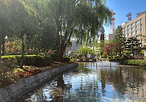
| Aoimori Park | |
|---|---|
 | |
 | |
| Location | Nagashima, Aomori, Japan |
| Coordinates | 40°49′27″N 140°44′31″E / 40.82417°N 140.74194°E |
| Area | 1.8 ha (4.4 acres) |
| Created | 1985 |
| Public transit access | Aomori City Bus |
Aoimori Park (青い森公園, Aoimori kōen) is a 1.8-hectare (4.4-acre) urban park in the central district of Aomori Prefecture's capital city, Aomori in northern Japan. Acting as an urban green space in the city's dense administrative district, it features various themed landscapes. It has been maintained by the prefectural government of Aomori since its opening in 1985. It is also the official ending point for National Route 4 and National Route 7. Various monuments and markers within and near the park denote the terminus of the two highways.