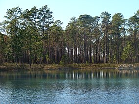
| Apalachicola National Forest | |
|---|---|
 | |
| Location | Florida, USA |
| Nearest city | Tallahassee, FL |
| Coordinates | 30°14′10″N 84°39′56″W / 30.23611°N 84.66556°W |
| Area | 632,890 acres (2,561.2 km2)[1] |
| Max. elevation | 184 ft. (56 m): 30.4326, -84.3855 |
| Created | May 13, 1936[2] |
| Governing body | U.S. Forest Service |
| Website | Apalachicola National Forest |
The Apalachicola National Forest is the largest U.S. National Forest in the state of Florida. It encompasses 632,890 acres (988.89 sq mi; 2,561.2 km2)[1] and is the only national forest located in the Florida Panhandle. The National Forest provides water and land-based outdoors activities such as off-road biking, hiking, swimming, boating, hunting, fishing, horse-back riding, and off-road ATV usage.[3]
Apalachicola National Forest contains two Wilderness Areas: Bradwell Bay Wilderness and Mud Swamp/New River Wilderness. There are also several special purpose areas: Camel Lake Recreation Area, Fort Gadsden Historical Site, Leon Sinks Geological Area, Silver Lake Recreation Area, Trout Pond Recreation Area, and Wright Lake Recreation Area. In descending order of forest land area it is located in parts of Liberty, Wakulla, Leon, and Franklin counties. [1] The forest is headquartered in Tallahassee, as are all three National Forests in Florida, but there are local forest ranger district offices located in Bristol and Crawfordville.
- ^ a b "Land Areas of the National Forest System" (PDF). U.S. Forest Service.
- ^ Proclamation 2169, 49 Stat. 3516 (May 13, 1936).
- ^ "Apalachicola National Forest".
