Apatity
Апатиты | |
|---|---|
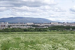
 Apatity and Khibiny Mountains | |
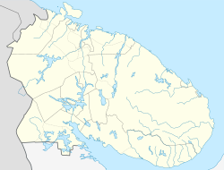
| Coordinates: 67°34′N 33°24′E / 67.567°N 33.400°E | |
| Country | Russia |
| Federal subject | Murmansk Oblast[1] |
| Urban locality | 1935[2] |
| Town status since | July 7, 1966[3] |
| Government | |
| • Mayor | Konstantin Gumenichenko |
| Elevation | 170 m (560 ft) |
| Population | |
• Total | 59,672 |
| • Rank | 276th in 2010 |
| • Subordinated to | Apatity Town with Jurisdictional Territory[1] |
| • Capital of | Apatity Town with Jurisdictional Territory[1] |
| • Urban okrug | Apatity Urban Okrug[5] |
| • Capital of | Apatity Urban Okrug[5] |
| Time zone | UTC+3 (MSK |
| Postal code(s)[7] | 184209 |
| Dialing code(s) | +7 81555 |
| OKTMO ID | 47705000001 |
| Website | apatity |
Apatity (Russian: Апатиты, IPA: [əpɐˈtʲitɨ], lit. apatites) is a town in Murmansk Oblast, Russia, located along the Murman Railway, 23 km (14 mi) west of Kirovsk and 185 km (115 mi) south of Murmansk, the administrative center of the oblast. The town is named after one of its most abundant natural resources in the area, apatite, the raw mineral used in the production of phosphorus mineral fertilizers. Population: 59,672 (2010 Census).[4]
| Year | Pop. | ±% |
|---|---|---|
| 1939 | 4,409 | — |
| 1959 | 13,958 | +216.6% |
| 1970 | 45,627 | +226.9% |
| 1979 | 62,010 | +35.9% |
| 1989 | 88,026 | +42.0% |
| 2002 | 64,405 | −26.8% |
| 2010 | 59,672 | −7.3% |
| 2021 | 49,647 | −16.8% |
| Population size may be affected by changes in administrative divisions. Source: Censuses[8][9][10][11] | ||
- ^ a b c d Cite error: The named reference
Ref395was invoked but never defined (see the help page). - ^ Энциклопедия Города России. Moscow: Большая Российская Энциклопедия. 2003. p. 22. ISBN 5-7107-7399-9.
- ^ Cite error: The named reference
ATSBook57was invoked but never defined (see the help page). - ^ a b Russian Federal State Statistics Service (2011). Всероссийская перепись населения 2010 года. Том 1 [2010 All-Russian Population Census, vol. 1]. Всероссийская перепись населения 2010 года [2010 All-Russia Population Census] (in Russian). Federal State Statistics Service.
- ^ a b Cite error: The named reference
Ref808was invoked but never defined (see the help page). - ^ "Об исчислении времени". Официальный интернет-портал правовой информации (in Russian). June 3, 2011. Retrieved January 19, 2019.
- ^ Local post office http://www.russianpost.ru/PostOfficeFindInterface/FindOPSByPostOfficeID.aspx?index=184209 Archived March 11, 2012, at the Wayback Machine
- ^ "(USSR) Urban population of the union republics, and their territorial units".
- ^ "Всероссийская перепись населения 2002 года. Том. 1, таблица 4. Численность населения России, федеральных округов, субъектов Российской Федерации, районов, городских поселений, сельских населённых пунктов - райцентров и сельских населённых пунктов с населением 3 тысячи и более". Archived from the original on February 3, 2012.
- ^ "Всероссийская перепись населения 2010 года. Итоги по Красноярскому краю. 1.10 Численность населения гор.округов, мун.районов, гор. и сел. поселе". Archived from the original on December 22, 2015.
- ^ "Таблица 5. Численность населения России, федеральных округов, субъектов Российской Федерации, городских округов, муниципальных районов, муниципальных округов, городских и сельских поселений, городских населенных пунктов, сельских населенных пунктов с населением 3000 человек и более - Итоги Всероссийской переписи населения 2021 года". Archived from the original on September 1, 2022. Retrieved October 1, 2021.


