| Araguainha crater | |
|---|---|
| Araguainha dome | |
 Landsat image of the Araguainha crater (May 2020) | |
| Impact crater/structure | |
| Confidence | Confirmed |
| Diameter | 40 km (25 mi) |
| Age | 254.7 ± 2.5 Ma Permian–Triassic boundary |
| Exposed | Yes |
| Drilled | No |
| Location | |
| Location | Paraná Basin |
| Coordinates | 16°48′S 52°59′W / 16.800°S 52.983°W |
| Country | Brazil |
| State | Goiás, Mato Grosso |
| Municipality | Araguainha & Ponte Branca |
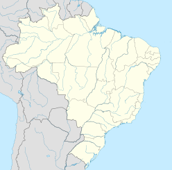
The Araguainha crater or Araguainha dome is an impact crater on the border of Mato Grosso and Goiás states, Brazil, between the villages of Araguainha and Ponte Branca.[1] With a diameter of 40 kilometres (25 mi), it is the largest known impact crater in South America.
The crater has most recently been dated to 254.7 ± 2.5 million years ago, when the region was probably a shallow sea. The margins of error of this date overlap the time of the Permian–Triassic extinction event, one of the largest mass extinction events in Earth's history.[2][3] The impact punched through Paleozoic sedimentary units belonging to the Paraná Basin formations, and exposed the underlying Ordovician granite basement rocks. It is estimated that the crater was initially 24 kilometres (15 mi) wide and 2.4 kilometres (1.5 mi) deep, which then widened to 40 kilometres (25 mi) as its walls subsided inwards.
- ^ "Araguainha". Earth Impact Database. Planetary and Space Science Centre University of New Brunswick Fredericton. Retrieved 2017-10-09.
- ^ Svetsov, Vladimir; Shuvalov, Valery (17 November 2019). "Trigger Effect of an Asteroidal or Cometary Impact at the Permian–Triassic Boundary". In Kocharyan, Gevorg; Lyakhov, Andrey (eds.). Trigger Effects in Geosystems. Springer Proceedings in Earth and Environmental Sciences. pp. 589–596. doi:10.1007/978-3-030-31970-0_62. ISBN 978-3-030-31969-4. S2CID 210344171.
- ^ Tohver, Eric; Cawood, P. A.; Riccomini, Claudio; Lana, Cris; Trindade, R. I. F. (1 October 2013). "Shaking a methane fizz: Seismicity from the Araguainha impact event and the Permian–Triassic global carbon isotope record". Palaeogeography, Palaeoclimatology, Palaeoecology. 387: 66–75. Bibcode:2013PPP...387...66T. doi:10.1016/j.palaeo.2013.07.010. Retrieved 29 November 2022.
