| Arakhley | |
|---|---|
| Арахле́й / Арахира нуур | |
 Landscape of the Arakhley lakeshore | |
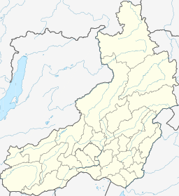
Location in Zabaykalsky Krai, Russian Far East | |
| Location | Vitim Plateau, South Siberian System |
| Coordinates | 52°12′10″N 112°52′30″E / 52.20278°N 112.87500°E[1] |
| Primary inflows | Domka, Gryaznukha |
| Primary outflows | Kholoy |
| Catchment area | 242 km2 (93 sq mi) |
| Basin countries | Zabaykalsky Krai, Russia |
| Max. length | 10.8 km (6.7 mi) |
| Max. width | 7 km (4.3 mi) |
| Surface area | 58.5 km2 (22.6 sq mi) |
| Average depth | 10 m (33 ft) |
| Max. depth | 19.5 m (64 ft) |
| Water volume | 0.61 km3 (0.15 cu mi) |
| Surface elevation | 965 m (3,166 ft) |
| Frozen | October to May |
| Islands | None |
| Settlements | Arakhley |
Arakhley (Russian: Арахле́й; Buryat: Арахира нуур) is a fresh water body in the Chita District, Zabaykalsky Krai, Russia. It is the 208th lake in Russia in water surface.[2][3] The villages of Arakhley and Preobrazhenka are located near the lakeshore. Arakhley is a locally well-known tourist destination and there are a number of resorts by the lake.
Lake Arakhley is located within the Ivano-Arakhley State Natural Landscape Reserve, a protected area of regional significance created in 1995, covering an area of 210,000 ha (520,000 acres).[2]
- ^ Google Earth
- ^ a b Cite error: The named reference
WRwas invoked but never defined (see the help page). - ^ "Озеро Арахлей in the State Water Register of Russia". textual.ru (in Russian).
