Arcata, California | |
|---|---|
 Arcata Plaza | |
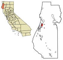
 Location within Humboldt County in California | |
| Coordinates: 40°52′5″N 124°5′26″W / 40.86806°N 124.09056°W | |
| Country | United States |
| State | California |
| County | Humboldt |
| Incorporated | February 2, 1858[1] |
| Government | |
| • Type | Council-Manager[2] |
| • Mayor | Sofia Pereira[3] |
| • City manager | Karen Diemer[4] |
| Area | |
| • Total | 11.44 sq mi (29.63 km2) |
| • Land | 9.42 sq mi (24.40 km2) |
| • Water | 2.02 sq mi (5.23 km2) 17.25% |
| Elevation | 23 ft (7 m) |
| Population (2020) | |
| • Total | 18,857 |
| • Density | 2,001.59/sq mi (772.83/km2) |
| Time zone | UTC−8 (Pacific Time Zone) |
| • Summer (DST) | UTC−7 (PDT) |
| ZIP codes | 95518, 95521 |
| Area code | 707 |
| FIPS code | 06-02476 |
| GNIS feature IDs | 277471, 2409723 |
| Website | www |
Arcata (/ɑːrˈkeɪ.tə/;[7] Wiyot: Goudi’ni;[8] Yurok: Oket'oh)[9] is a city adjacent to the Arcata Bay (northern) portion of Humboldt Bay in Humboldt County, California, United States. At the 2020 census, Arcata's population was 18,857. Arcata was first founded in 1850 as Union, was officially established in 1858, and was renamed Arcata in 1860. It is located 280 miles (450 km) north of San Francisco (via Highway 101), and is home to California State Polytechnic University, Humboldt. Arcata is also the location of the Arcata Field Office of the Federal Bureau of Land Management, which is responsible for the administration of natural resources, lands and mineral programs, including the Headwaters Forest, on approximately 200,000 acres (810 km2) of public land in Northwestern California.
- ^ "California Cities by Incorporation Date". California Association of Local Agency Formation Commissions. Archived from the original (Word) on November 3, 2014. Retrieved April 7, 2013.
- ^ "Government". City of Arcata. Archived from the original on April 2, 2015. Retrieved March 13, 2015.
- ^ "City Council". City of Arcata. Retrieved June 16, 2021.
- ^ "City Manager". City of Arcata. Archived from the original on January 9, 2015. Retrieved December 30, 2014.
- ^ "2020 U.S. Gazetteer Files". United States Census Bureau. Retrieved October 30, 2021.
- ^ "Arcata". Geographic Names Information System. United States Geological Survey, United States Department of the Interior.
- ^ Bright, William (1998). 1500 California Place Names: Their Origin and Meaning. Berkeley, CA: University of California Press.
- ^ "About Arcata". Visit Arcata!.
- ^ "City of Arcata". www.cityofarcata.org. Retrieved February 3, 2020.


