This article needs additional citations for verification. (August 2016) |
Areekode | |
|---|---|
Town | |
 | |
 | |
| Coordinates: 11°14′16″N 76°03′00″E / 11.237716°N 76.050088°E | |
| Country | |
| State | Kerala |
| District | Malappuram |
| Government | |
| • Type | Block Panchayath |
| • Body | UDF |
| Languages | |
| • Official | Malayalam, English |
| Time zone | UTC+5:30 (IST) |
| PIN | 673639 |
| Telephone code | 0483 |
| Vehicle registration | KL-84 |
| Website | http://www.areekode.com/ |
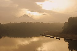
Areekode is a town on the banks of the Chaliyar River in Areekode Grama Panchayat in Malappuram district, India. It was part of the Malabar district in British India.
Areekode has an area of 7.25 square miles, and is one of the highly literate areas in the state of Kerala. Situated in the Northern part of Malappuram district, it is encircled by hills and hillocks capped in green. The Areekode region includes Urangatiri, Kizhuparamba, Kavanoor and Areekode panchayats
It is 17 km from Manjeri, 27 km from Malappuram, and 35 km from Calicut town.