| Arikaree River Arikara Fork Republican River | |
|---|---|
 Arikaree River Valley at the location of the Battle of Beecher Island near Wray, Colorado | |
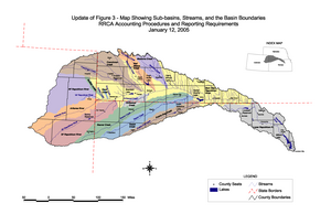
 Republican River watershed; the Arikaree is in orange at far left | |
| Etymology | Arikaree for horn |
| Native name | Ononio'he (Arikara) |
| Location | |
| Country | United States |
| State | Colorado, Kansas, Nebraska |
| Physical characteristics | |
| Source | |
| • location | Elbert County, Colorado |
| • coordinates | 39°22′36″N 103°46′44″W / 39.37667°N 103.77889°W |
| • elevation | 5,908 ft (1,801 m) |
| Mouth | Republican River |
• location | Haigler, Nebraska |
• coordinates | 40°01′13″N 101°56′17″W / 40.02028°N 101.93806°W[1] |
• elevation | 3,241 ft (988 m) |
| Length | 156 mi (251 km) |
| Basin size | 1,743 sq mi (4,510 km2) |
| Discharge | |
| • location | USGS 06821500 at Haigler, NE[2] |
| • average | 16.7 cu ft/s (0.47 m3/s) |
| • minimum | 0 cu ft/s (0 m3/s) |
| • maximum | 17,000 cu ft/s (480 m3/s) |
| Basin features | |
| Tributaries | |
| • left | North Fork Arikaree River - Black Wolf Creek |
| Watersheds | Arikaree-Republican-Kansas- Missouri-Mississippi |
The Arikaree River /əˈrɪkəri/ is a 156-mile-long (251 km)[3] river in the central Great Plains of North America. It lies mostly in the American state of Colorado, draining land between the North and South Forks of the Republican River, and it flows into the North Fork in Nebraska after flowing a short distance through Kansas.[4] It is a designated area within the Colorado Natural Areas Program to protect native and uncommon species that may be endangered or threatened.
- ^ "Arikaree River". Geographic Names Information System. United States Geological Survey, United States Department of the Interior. Retrieved 2011-02-01.
- ^ "Water-Data Report 2012 - 06821500 Arikaree River at Haigler, NE" (PDF). U.S. Geological Survey. Retrieved 2015-12-04.
- ^ "National Hydrography Dataset". National Hydrography Dataset. United States Geological Survey. Retrieved 14 June 2011.
- ^ Cite error: The named reference
TravelMapwas invoked but never defined (see the help page).