| Route information | ||||
|---|---|---|---|---|
| Maintained by ADOT | ||||
| Length | 32.60 mi[1] (52.46 km) | |||
| Existed | 1959–present | |||
| Major junctions | ||||
| West end | ||||
| East end | ||||
| Location | ||||
| Country | United States | |||
| State | Arizona | |||
| Highway system | ||||
| ||||
| ||||

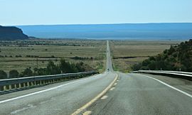
State Route 389, also known as SR 389, is a state highway in far northern Arizona serving the Arizona Strip. SR 389 stretches from the Utah border at Colorado City, southeast to Pipe Spring National Monument, and ends at U.S. Route 89A in Fredonia; it is the only major east–west route between these two towns, and also serves to connect Fredonia with points farther west such as St. George, Utah.
- ^ Arizona Department of Transportation. "2008 ADOT Highway Log" (PDF). Archived from the original (PDF) on December 28, 2010. Retrieved April 8, 2008.

