 | ||||
| Route information | ||||
| Maintained by ArDOT | ||||
| Length | 99.14 mi[1] (159.55 km) | |||
| Existed | 1926–present | |||
| Major junctions | ||||
| South end | ||||
| North end | ||||
| Location | ||||
| Country | United States | |||
| State | Arkansas | |||
| Counties | Johnson, Newton, Madison, Carroll | |||
| Highway system | ||||
| ||||
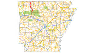
Arkansas Highway 21 (AR 21) is a north–south state highway in north central Arkansas. The route runs 99.14 miles (159.55 km) from U.S. Route 64 (US 64) in Clarksville north across US 62 to the Missouri state line.[2] The route is a two-lane highway with the exception of a brief concurrency with US 62, a four-lane highway, in Berryville.[1]
- ^ a b Planning and Research Division (2010). "Arkansas Road Log Database". Arkansas State Highway and Transportation Department. Archived from the original (Database) on 23 June 2011. Retrieved June 9, 2011.
- ^ General Highway Map, Carroll County, Arkansas (PDF) (Map). 1:62500. Cartography by Planning and Research Division. Arkansas State Highway and Transportation Department. 2010. Retrieved June 25, 2011.
