You can help expand this article with text translated from the corresponding article in Spanish. (June 2015) Click [show] for important translation instructions.
|
Arthabaska | |
|---|---|
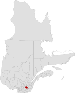
 Location in Quebec | |
| Coordinates: 45°55′N 72°05′W / 45.917°N 72.083°W[1] | |
| Country | Canada |
| Province | Quebec |
| Region | Centre-du-Québec |
| Effective | January 1, 1982 |
| County seat | Victoriaville |
| Government | |
| • Type | Prefecture |
| • Prefect | Lionel Fréchette |
| Area | |
• Total | 1,910.60 km2 (737.69 sq mi) |
| • Land | 1,890.18 km2 (729.80 sq mi) |
| Population (2016)[3] | |
• Total | 72,014 |
| • Density | 38.1/km2 (99/sq mi) |
| • Change 2011-2016 | |
| • Dwellings | 33,483 |
| Time zone | UTC−05:00 (EST) |
| • Summer (DST) | UTC−04:00 (EDT) |
| Area code | 819 |
| Website | www |
| [4] | |
Arthabaska Regional County Municipality is a regional county municipality located in the Centre-du-Québec region of Quebec. Its seat is Victoriaville.[2]
- ^ Cite error: The named reference
toponymiewas invoked but never defined (see the help page). - ^ a b c "Répertoire des municipalités: Geographic code 390". www.mamh.gouv.qc.ca (in French). Ministère des Affaires municipales et de l'Habitation.
- ^ a b "Census Profile, 2016 Census: Arthabaska, Municipalité régionale de comté [Census division], Quebec". Statistics Canada. Retrieved November 26, 2019.
- ^ "Arthabaska Regional County Municipality (Code 2439) Census Profile". 2011 census. Government of Canada - Statistics Canada.