Arusha Region
Mkoa wa Arusha (Swahili) | |
|---|---|
| Nickname(s): Cradle of Humankind; Land of Volcanoes; The Craters Region | |
 Location in Tanzania | |
| Coordinates: 3°23′12.84″S 36°40′58.8″E / 3.3869000°S 36.683000°E | |
| Country | |
| Zone | Northern |
| Named for | Arusha people |
| Capital | Arusha City |
| Districts | |
| Government | |
| • Regional Commissioner | John Mongella |
| Area | |
• Total | 37,576 km2 (14,508 sq mi) |
| • Land | 33,809 km2 (13,054 sq mi) |
| • Water | 707 km2 (273 sq mi) |
| • Rank | 9th of 31 |
| Highest elevation (Socialist Peak, Mount Meru) | 4,562 m (14,967 ft) |
| Population (2022) | |
• Total | 2,356,255 |
| • Rank | 11th of 31 |
| • Density | 63/km2 (160/sq mi) |
| Demonym | Arushan |
| Ethnic groups | |
| • Settler | Swahili & Maasai |
| • Native | Hadzabe, Chaga, Pare, Iraqw, Datooga, ,Rwa & Arusha people |
| Time zone | UTC+3 (EAT) |
| Postcode | 23xxx |
| Area code | 027 |
| ISO 3166 code | TZ-01 |
| HDI (2021) | 0.568[1] medium · 9th of 25 |
| Website | Official website |
| Symbols of Tanzania | |
| Bird |  |
| Butterfly | |
| Fish | |
| Mammal |  |
| Tree | |
| Mineral | Gregoryite |
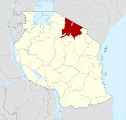
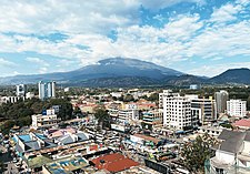
Arusha Region (Swahili: Mkoa wa Arusha) is one of Tanzania's 31 administrative regions and is located in the northeast of the country. The region's capital and largest city is the city of Arusha. The region is bordered by Kajiado County and Narok County in Kenya to the north, the Kilimanjaro Region to the east, the Manyara and Singida Regions to the south, and the Mara and Simiyu regions to the west. Arusha Region is home to Ngorongoro Conservation Area, a UNESCO World Heritage Site. The region is comparable in size to the combined land and water areas of the state of Maryland in the United States.[2]
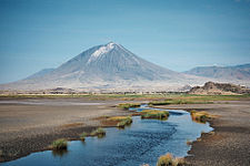
Arusha Region is a tourist destination in Africa and is the hub of the northern Tanzania safari circuit. The national parks and nature reserves in this region include Ngorongoro Conservation Area, Arusha National Park, the Loliondo Game Controlled Area, and part of Lake Manyara National Park. Remains of 600-year-old stone structures are found at Engaruka, just off the dirt road between Mto wa Mbu and Lake Natron. With a HDI of 0.721, Arusha is among the most developed regions of Tanzania being Tanzania's top 3 most resourceful region.[3]
- ^ "Sub-national HDI - Area Database - Global Data Lab". hdi.globaldatalab.org. Archived from the original on 2018-09-23. Retrieved 2020-02-26.
- ^ 32,131 km2 (12,406 sq mi) for Maryland at "Land and Water Area of States and Other Entities" (PDF). Bureau of the Census. 2008. Archived from the original (PDF) on 17 October 2011. Retrieved 10 April 2013.
34,506 km2 (13,323 sq mi) for Arusha. - ^ Economic Transformation for Human Development Archived 2015-07-05 at the Wayback Machine


