| Ashbury | |
|---|---|
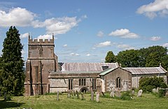
 St Mary the Virgin parish church | |
 War memorial and public green with neighbouring houses. | |
Location within Oxfordshire | |
| Area | 22.47 km2 (8.68 sq mi) |
| Population | 506 (2011 Census) |
| • Density | 23/km2 (60/sq mi) |
| OS grid reference | SU2685 |
| Civil parish |
|
| District | |
| Shire county | |
| Region | |
| Country | England |
| Sovereign state | United Kingdom |
| Post town | Swindon |
| Postcode district | SN6 |
| Dialling code | 01793 |
| Police | Thames Valley |
| Fire | Oxfordshire |
| Ambulance | South Central |
| UK Parliament | |
| Website | Ashbury Parish News |
Ashbury is a village and large civil parish at the upper end (west) of the Vale of White Horse. It was part of Berkshire until the 1974 boundary changes transferred it to Oxfordshire. The village is centred 7 miles (11 km) east of Swindon in neighbouring Wiltshire.[1] The parish includes the hamlets of Idstone and Kingstone Winslow. The 2011 Census recorded the parish's population as 506.[2]
- ^ AA Book of British Villages. Drive Publications Limited. 1980. p. 31. ISBN 9780340254875.
- ^ "Area: Ashbury (Parish): Key Figures for 2011 Census: Key Statistics". Neighbourhood Statistics. Office for National Statistics. Archived from the original on 12 June 2011. Retrieved 14 February 2015.
