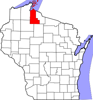
Ashland County | |
|---|---|
 | |
 Location within the U.S. state of Wisconsin | |
 Wisconsin's location within the U.S. | |
| Coordinates: 46°43′N 90°34′W / 46.71°N 90.56°W | |
| Country | |
| State | |
| Founded | March 27, 1860 |
| Named for | Henry Clay's farm Ashland |
| Seat | Ashland |
| Largest city | Ashland |
| Area | |
| • Total | 2,292 sq mi (5,940 km2) |
| • Land | 1,045 sq mi (2,710 km2) |
| • Water | 1,247 sq mi (3,230 km2) 54% |
| Population | |
| • Total | 16,027 |
| • Estimate (2023) | 16,079 |
| • Density | 15.3/sq mi (5.9/km2) |
| Time zone | UTC−6 (Central) |
| • Summer (DST) | UTC−5 (CDT) |
| Congressional district | 7th |
| Website | www |
Ashland County is a county located in the U.S. state of Wisconsin. As of the 2020 census, the population was 16,027.[1] Its county seat is Ashland.[2] The county was formed on March 27, 1860, from La Pointe County.[3] The county partly overlaps with the reservation of the Bad River Band of the Lake Superior Tribe of Chippewa Indians.
- ^ a b Cite error: The named reference
2020-census-55003was invoked but never defined (see the help page). - ^ "Find a County". National Association of Counties. Archived from the original on May 31, 2011. Retrieved June 7, 2011.
- ^ "Wisconsin History: La Pointe County (obsolete)". Archived from the original on June 11, 2011. Retrieved September 20, 2008.