| Asir Mountains | |
|---|---|
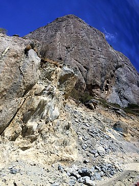
 A rocky mountain in the range | |
| Naming | |
| Native name | جِبَال عَسِيْر (Arabic) |
| Geography | |
| Country | |
| Region | Arabian Peninsula |
| Range coordinates | 21°36′N 39°48′E / 21.6°N 39.8°E |
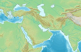
The Asir Mountains[1] (Arabic: جِبَال عَسِيْر, jibāl ʿasīr; Arabic pronunciation: [d͡ʒɪbaːl ʕasiːr] ('Difficult')) is a mountainous region in southwestern Saudi Arabia running parallel to the Red Sea. It comprises areas in the Region of 'Asir, but generally, it also includes areas near the border with Yemen. The mountains cover approximately 100,000 square kilometres (40,000 sq mi) and consists of mountains, plains, and valleys of the Arabian highlands.[2] Sensu lato, they are part of the Sarawat Mountains,[3] defining the latter as the mountain range which runs parallel to the Tihamah throughout the western portion of the Arabian Peninsula, particularly the western parts of Saudi Arabia and Yemen.[4][5][6]
- ^ "Library of Congress Country Study: Saudi Arabia", The Library of Congress, archived from the original on 2008-09-23
- ^ "Southwestern Arabian montane woodlands". Terrestrial Ecoregions. World Wildlife Fund.
- ^ Overstreet, William Courtney (1977). Tertiary laterite of the As Sarat Mountains, Asir Province, Kingdom of Saudi Arabia. Vol. 2. Directorate General of Mineral Resources. pp. iii–2.
- ^ Nasr, Seyyed Hossein (2013). "1: The Holiest Cities of Islam". Mecca the Blessed, Medina the Radiant: The Holiest Cities of Islam. Tuttle Publishing. ISBN 978-1-4629-1365-7.
- ^ Judas, J.; Paillat, P.; Khoja, A.; Boug, A. (2006). "Status of the Arabian leopard in Saudi Arabia" (PDF). Cat News. Special Issue 1: 11–19.
- ^ Spalton, J. A. & Al-Hikmani, H. M. (2006). "The Leopard in the Arabian Peninsula – Distribution and Subspecies Status" (PDF). Cat News (Special Issue 1): 4–8. Archived from the original on May 23, 2011.
{{cite journal}}: CS1 maint: unfit URL (link)


