Asperen | |
|---|---|
Small city | |
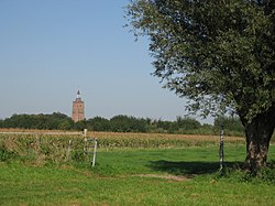
 Tower of the Protestant church in Asperen | |
Location of Gelderland in the Netherlands | |
| Coordinates: 51°52′53″N 5°6′24″E / 51.88139°N 5.10667°E | |
| Country | Netherlands |
| Province | Gelderland |
| Municipality | West Betuwe |
| Area | |
| • Total | 3.32 km2 (1.28 sq mi) |
| Elevation | 3.7 m (12.1 ft) |
| Population (2021)[1] | |
| • Total | 3,205 |
| • Density | 970/km2 (2,500/sq mi) |
| Time zone | UTC+1 (CET) |
| • Summer (DST) | UTC+2 (CEST) |
| Postal code | 4147[1] |
| Dialing code | 0345 |
Asperen is a small city in the Dutch province of Gelderland. It is a part of the municipality of West Betuwe, and lies about 10 km (6 miles) east of Gorinchem on the river Linge. It received city rights in 1313.[3][4]
- ^ a b c "Kerncijfers wijken en buurten 2021". Central Bureau of Statistics. Retrieved 14 April 2022.
- ^ "Postcodetool for 4147AA". Actueel Hoogtebestand Nederland (in Dutch). Het Waterschapshuis. Retrieved 14 April 2022.
- ^ "Asperen". Plaatsengids (in Dutch). Retrieved 14 April 2022.
- ^ Cite error: The named reference
etymwas invoked but never defined (see the help page).


