| Assateague State Park | |
|---|---|
 Feral horses in Assateague State Park | |
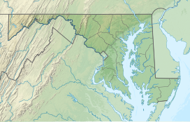
| Location | Worcester County, Maryland, United States |
| Nearest city | Ocean City, Maryland |
| Coordinates | 38°15′10″N 75°7′40″W / 38.25278°N 75.12778°W[1] |
| Area | 855 acres (346 ha)[2] |
| Elevation | 3 ft (0.91 m)[1] |
| Established | 1956 |
| Administered by | Maryland Department of Natural Resources |
| Designation | Maryland state park |
| Website | Official website |
Assateague State Park is a public recreation area in Worcester County, Maryland, located at the north end of Assateague Island, a barrier island bordered by the Atlantic Ocean on the east and Sinepuxent Bay on the west. The state park is bordered on both its north and south sides by Assateague Island National Seashore and is reached via the Verrazano Bridge which carries Maryland Route 611 across Sinepuxent Bay. The park offers wildlife viewing, beach activities, and camping facilities. It is managed by the Maryland Park Service of the larger Maryland Department of Natural Resources with the support of volunteers working under the auspices of the non-profit Friends of Assateague State Park.[3][4]
- ^ a b "Assateague Island". Geographic Names Information System. United States Geological Survey, United States Department of the Interior.
- ^ Cite error: The named reference
acreagereportwas invoked but never defined (see the help page). - ^ Cite error: The named reference
mdnrwas invoked but never defined (see the help page). - ^ Cite error: The named reference
mdnr2was invoked but never defined (see the help page).
