Astypalaia
Αστυπάλαια | |
|---|---|
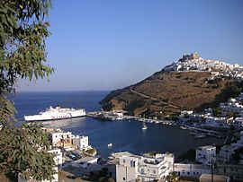
 Astypalaia (harbour) | |
| Coordinates: 36°33′N 26°21′E / 36.550°N 26.350°E | |
| Country | Greece |
| Administrative region | South Aegean |
| Regional unit | Kalymnos |
| Area | |
| • Municipality | 114.1 km2 (44.1 sq mi) |
| Highest elevation | 506 m (1,660 ft) |
| Lowest elevation | 0 m (0 ft) |
| Population (2021)[1] | |
| • Municipality | 1,376 |
| • Density | 12/km2 (31/sq mi) |
| Time zone | UTC+2 (EET) |
| • Summer (DST) | UTC+3 (EEST) |
| Postal code | 859 00 |
| Area code(s) | 22430 |
| Vehicle registration | ΚΧ, ΡΟ, ΡΚ |
| Website | astipalea |
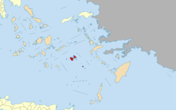
Astypalaia (Greek: Αστυπάλαια, pronounced [astiˈpalea]), is a Greek island with 1,334 residents (2011 census). It belongs to the Dodecanese, an archipelago of fifteen major islands in the southeastern Aegean Sea. However, many scholars recognize Astypalaia as an extension of the Cyclades, as many cultural[2] and ecological[3] components of the island are more indicative of the Cyclades rather than the Dodecanese.
The island is 18 kilometres (11 miles) long, 13 kilometres (8 miles) across at its widest, and covers an area of 97 km2.[4] Along with numerous smaller uninhabited offshore islets (the largest of which are Sýrna and Ofidoussa), it forms the Municipality of Astypalaia, which is part of the Kalymnos regional unit. The municipality has an area of 114.077 km2.[5] The capital and the previous main harbour of the island is Astypalaia or Chora, as it is called by the locals.
- ^ "Αποτελέσματα Απογραφής Πληθυσμού - Κατοικιών 2021, Μόνιμος Πληθυσμός κατά οικισμό" [Results of the 2021 Population - Housing Census, Permanent population by settlement] (in Greek). Hellenic Statistical Authority. 29 March 2024.
- ^ Vlachopoulos, Andreas; Angelopoulou, Anastasia (2019). Early Cycladic Sculpture in Context from Beyond the Cyclades: Mainland Greece, the North and East Aegean. p. 202-226.
- ^ Cattaneo, Cristina; Grano, Mauro (2016). "Contribution to the knowledge of vascular flora on Astypalea Island (Dodecanese, Greece)". Phytologia Balcanica. 22 (3).
- ^ "Astypalaia" in The New Encyclopædia Britannica. Chicago: Encyclopædia Britannica Inc., 15th edn., 1992, Vol. 1, p. 651.
- ^ "Population & housing census 2001 (incl. area and average elevation)" (PDF) (in Greek). National Statistical Service of Greece. Archived from the original (PDF) on 2015-09-21.

