Parts of this article (those related to Alive Festival) need to be updated. (September 2017) |
| Atwood Lake | |
|---|---|
 | |
 | |
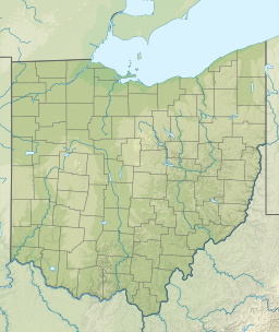
| Location | Carroll County / Tuscarawas County, Ohio, U.S. |
| Coordinates | 40°31′36″N 81°17′05″W / 40.52667°N 81.28472°W[1] |
| Type | reservoir |
| Primary inflows | Indian Fork and others |
| Primary outflows | Indian Fork |
| Catchment area | 70 sq mi (180 km2)[2] |
| Basin countries | United States |
| Max. length | 8.5 mi (13.7 km) to 10.7 mi (17.2 km)[2] |
| Surface area | 1,540 acres (6.2 km2) to 2,460 acres (10.0 km2)[2] |
| Water volume | 23,600 to 49,700 acre-feet (29,100,000 to 61,300,000 m3) |
| Surface elevation | 928 ft (283 m) to 941 ft (287 m)[2] |
| Settlements | Dellroy, Ohio |
Atwood Lake is a reservoir located in Tuscarawas and Carroll counties in east central Ohio. The lake is formed by Atwood Dam 40°31′36″N 81°17′5″W / 40.52667°N 81.28472°W[3] across Indian Fork,[4] a tributary of Conotton Creek. The lake is named for the community of Atwood 40°31′36″N 81°17′5″W / 40.52667°N 81.28472°W[5][6][7] which was purchased, demolished and inundated. Evidence of an old rail station and roadbed can also be seen near Dellroy when the lake level is drawn down for winter.[8] In addition to the Indian Fork the lake also has coves to the north up Elliott Run, Willow Run and two unnamed streams along Bark Road and Ohio State Route 542. The dam was completed in September 1936 at a cost of $1,403,900 by the Muskingum Watershed Conservancy District.[2] The operation of the lake and dam, along with the property immediately surrounding the dam site, was transferred to the U.S. Army Corps of Engineers, Huntington District, after the approval of the Flood Control Act of 1939 by Congress. The MWCD continues to be responsible for the management of much of the reservoir areas behind the dam, serving as a partner to the U.S. Army Corps of Engineers for flood reduction. In addition to operating a number of recreation facilities, the MWCD cooperates with the Ohio Division of Wildlife for fishing and hunting management.
- ^ "Geographic Names Information System entry for Atwood Lake". Retrieved 2010-03-13.
- ^ a b c d e Lake Levels - Muskingum Watershed Conservancy District click on “Atwood“ under "Project"
- ^ Geographic Names Information System. "GNIS entry for Atwood Dam (Feature ID #1077630)". Retrieved 2010-01-07.
- ^ Geographic Names Information System. "GNIS entry for Indian Fork (Feature ID #1066761)". Retrieved 2010-01-07.
- ^ Geographic Names Information System. "GNIS entry for Atwood Village (Feature ID #1052415)". Retrieved 2010-01-07.
- ^ "Carroll County Historical Society". www.carrollcountyohio.com.
- ^ "Carroll County Historical Society" (PDF). www.carrollcountyohio.com.
- ^ "Carroll County Historical Society" (PDF). www.carrollcountyohio.com.
