| Au Sable River Beauais River, Rivière au sable | |
|---|---|
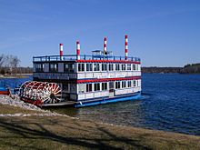
 The Au Sable River in Alcona County | |
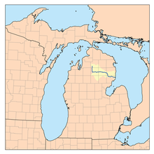
 Map of the Au Sable River | |
| Location | |
| Country | United States |
| Physical characteristics | |
| Source | |
| • location | Frederic Township, Crawford County, Michigan |
| Mouth | |
• location | Lake Huron at Au Sable, Michigan |
• elevation | 581 ft (177 m)[1] |
| Length | 138 miles (222 km) |
| Type | Scenic |
| Designated | October 4, 1984 |


The Au Sable River (/ɔː ˈsɑːbəl/ aw SAH-bəl) is a 138-mile-long (222 km)[2] river in the Lower Peninsula of the U.S. state of Michigan. Rising in the Northern Lower Peninsula, the river flows in a generally southeasterly direction to its mouth at Lake Huron at the communities of Au Sable and Oscoda. It is considered one of the best brown trout fisheries east of the Rockies[3] and has been designated a blue ribbon trout stream by the Michigan Department of Natural Resources.[4] A map from 1795 located in the United States Gazetteer calls it the Beauais River.[5] In French, the river is called the Rivière au sable, literally "Sand River".
- ^ Cite error: The named reference
gniswas invoked but never defined (see the help page). - ^ U.S. Geological Survey. National Hydrography Dataset high-resolution flowline data. The National Map Archived 2012-03-29 at the Wayback Machine, accessed November 7, 2011
- ^ Card, James (January 24, 2017). "In Michigan, a Fight Over the Future of a Fabled Trout River". The New York Times. Retrieved January 28, 2017.
- ^ "Blue Ribbon Trout Streams".
- ^ "Au Sable River Natural River Plan" (PDF). July 1987. Retrieved June 23, 2022.