A major contributor to this article appears to have a close connection with its subject. (February 2024) |
ʻAūa | |
|---|---|
Village | |
| Coordinates: 14°16′11″S 170°39′50″W / 14.26972°S 170.66389°W | |
| Country | |
| Territory | |
| Island | Tutuila Island |
| Area | |
| • Total | 1.11 sq mi (2.88 km2) |
| Population (2020) | |
| • Total | 1,549 |
| • Density | 1,400/sq mi (540/km2) |
| Demonym | Auan[1] |
| Time zone | Samoa Time Zone |
| • Summer (DST) | UTC−11 |
| ZIP code | 96799 |
| Area code | +1 684 |
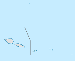
Aūa is a village on Tutuila Island in American Samoa. It is located along American Samoa Highway 001, and is the southern terminus of American Samoa Highway 006. Aūa is located at the foothills of Mount Peiva on the eastern shore of Pago Pago Bay.[2][3] The hamlet of Leloaloa is also a part of Aūa.[4]
Corals off the village of Aūa have been the subject of what’s thought to be the world’s longest-running reef survey. It has attracted scientists from throughout the world every year since 1917.[5] In 1917 Alfred G. Mayer from the Carnegie Institution for Science established what has now become the oldest periodically re-surveyed coral-reef transect in the world at Aua.[6]
Sa’ousoalii is a traditional salutation to the villages of Aua and Fagatogo in the Greater Pago Pago Area.[7]
- ^ Gray, John Alexander Clinton (1980). Amerika Samoa. Arno Press. Page 95. ISBN 9780405130380.
- ^ Krämer, Augustin (2000). The Samoa Islands. University of Hawaii Press. Page 438. ISBN 9780824822194.
- ^ Sunia, Fofō Iosefa Fiti (2001). Puputoa: Host of Heroes - A record of the history makers in the First Century of American Samoa, 1900-2000. Suva, Fiji: Oceania Printers. Page 190. ISBN 9829036022.
- ^ Krämer, Augustin (2000). The Samoa Islands. University of Hawaii Press. Page 438. ISBN 9780824822194.
- ^ "American Samoan reef surveyed over 100 years". 22 May 2017.
- ^ "American Samoans urged to protect AUA coral". 26 May 2017.
- ^ Sunia, Fofō Iosefa Fiti (2001). Puputoa: Host of Heroes - A record of the history makers in the First Century of American Samoa, 1900-2000. Suva, Fiji: Oceania Printers. Page 193. ISBN 9829036022.
