| Austin Creek State Recreation Area | |
|---|---|
 Austin Creek State Recreation Area | |
| Location | Sonoma County, California, United States |
| Nearest city | Guerneville, California |
| Coordinates | 38°34′1″N 123°3′11″W / 38.56694°N 123.05306°W |
| Area | 5,927 acres (23.99 km2) |
| Established | 1964 |
| Governing body | California Department of Parks and Recreation |
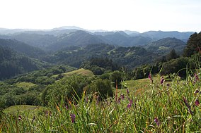
Austin Creek State Recreation Area is a state park unit of California, United States, encompassing an isolated wilderness area. It is located in Sonoma County, California, adjacent to Armstrong Redwoods State Natural Reserve, with which it shares a common entrance. Its rugged topography includes ravines, grassy hillsides, oak-capped knolls, and rocky summits offering glimpses of the Pacific Ocean. There are 20 miles (30 km) of trails, panoramic wilderness views, and camping (both back-country and vehicle-accessible). The remains of Pond Farm artists' colony (dating from the 1940s) are also included in the Austin Creek SRA.

